
Military geography
Military geography or military geography is an independent, special discipline of military science (military science, war science ) and researches the political, economic and physical-geographical conditions as well as the operational expansion of the territory of the various states and theaters of war with regard to their possible influences on the preparation and implementation of Actions by the armed forces, including armed struggle.
.jpg)
The results of such military-geographic examinations and assessments are made available to the command organs and troops (forces) in the form of verbal military-geographic descriptions and special military-geographic maps.


Military geography in military geospatial
Sub-areas of the military geospatial
In the interests of the armed forces, the military geospatial system (geographic information) uses interdisciplinary disciplines and branches from the areas of social, natural and technical sciences, in particular geosciences.
This includes, above all, military cartography as a military-technical scientific discipline , in order to plan and carry out combat operations and orientation in the field for the tactical deployment of units, troop units and formations as well as for operational and operational-strategic actions of large formations (operational-tactical formations and operational Associations).
Military geospatial science usually comprises the following branches and components as well as the associated facilities and services:
- Military geography;
- Military topography, military geodesy;
- Military cartography, military photogrammetry;
- Military hydrography, military hydrometeorology, military meteorology;
- Military digital geospatial.
The components of the military geospatial system (geographic information system) are defined differently in the various states (groups of states). In the literature z. For example, the terms military geography, military geology, security geography (Security Geo-complex) and political geography (Russian, политическая география) can be found.
The term Military Geography used between the NATO allies therefore covers the extended meaning of the German-language equivalent of military geography and not just the scientific discipline of military geography .
Overarching areas, object and subject matter of military geography
Military geography is a special discipline of military science and a science related to geography. According to states (groups of states), regions and theaters of war, it examines the political balance of power, the economic and military possibilities of the states (coalitions) as well as the political, economic and physical-geographical conditions that have a possible influence on the preparation and implementation of actions by the armed forces , including armed struggle and war.
It takes on other disciplines and branches from the areas of social, natural and technical sciences and examines their areas and natural and human resources as far as they are relevant for military purposes in military-strategic and operational planning .
The object of military geography is the geographical space of various dimensions as the sphere of action of the armed forces in times of peace, periods of tension and war. The room categories are specified by the military-political leadership.
The subject of military geography is the interrelationship between armed forces, society and nature in the geosphere (continental and maritime) of different dimensions in its spatial differentiation and interdependence in times of peace, periods of tension and war.
Sub-areas of military geography
Sub-areas of military geography are:
- the theory of military geography (also: general principles);
- the historical military geography;
- military geography (military geography),
- the study (description) of theaters of war and spatial analyzes,
- the maritime military geography.
Maritime military geography pays attention to the study of the physical-geographical and nautical-hydrographic conditions of seas, oceans and theaters of war.
The areas of military geography are usually worked on from two perspectives: from the theoretical and the applied. The considerable distance between the two parts, as between theory and military practice in general, must be taken into account.
Like the definition, the sub-areas of military geography are not conclusively determined. Assesses the military geography geographical factors and conditions primarily as factors influencing the actions of the armed forces, which had Wehrgeographi e primarily to explore the political and strategic influences on the security of the state (of groups of states).
history
prehistory
People who act in society have always had to deal with the surrounding nature. With the increasing productivity of people, the immediate and spontaneous relationships with nature changed into new forms of dealing with the physical-geographical conditions of their work and living spaces.
At the same time, social relationships developed between social groups to defend acquired property and to gain wealth. Extensive battles were waged, wars were prepared and waged, and more and more people and larger areas on earth were involved in armed conflicts. The effective preparation and successful implementation of combat operations has always been linked to timely and comprehensive consideration of all external influencing factors and conditions, including military-geographical ones.
The possible periodization of the development to a military geographic science is on the one hand linked to the achievements of individual personalities, which triggered qualitative leaps in the knowledge process. On the other hand, caesuras in the methods of combat practiced and in the art of war influenced military-geographical activities.
Terrain in ancient times and in the Middle Ages
The beginnings of military geography lie in antiquity - with the sensible use of the terrain and traffic conditions, especially in Roman times with the expansion of long-distance traffic routes.
A systematic preoccupation with the influence of the terrain can be seen in the book The Art of War by the Chinese General Sunzi (Ssun – Ds') in the 5th century BC. In 4 of 13 book chapters, it obliges the generals to include the terrain in their deliberations on punishment for their downfall and thus assigns regional and topographical assessments to the higher level of the art of war, the strategy. Translations of the script first appeared in Russia (1889), England and Germany (1910), the Soviet Union (1943, 1950), the GDR (1957) and in almost 70 German-language editions in the 2000s.


Ssun – Ds': Treatise on the art of war. Title page, transl. From Altchines. ins Russ., German transfer, 1957

Hodometer anagoria, tool used by the Bematists (pedometer) in antiquity

Example for route maps (Itinarien) of the Caesar time, Corpus Agrimensorum Romanorum

.jpg)
,_Corpus_Agrimensorum_Romanorum.jpg)
Alexander of Macedonia (356 to 323 B.C.E.) employed a topographical troop in his army, the Bematists (pedometers), who mapped conquered areas. A similar troop has come down to us from the Caesar period (100 to 44 B.C.E.) - the agrimensors (mensors), which provided highly distorted route maps (itinariums). These descriptions, called topographies , can be seen as precursors to contemporary military-geographic descriptions. Similar geographical works have not come down to us from the Germanic tribes, e.g. B. in the ethno-geographic study by Tacitus Germania (98 C.E.) on the Germanic people.
Applied geography in the early modern period
The epoch of great geographical discoveries that followed the Middle Ages (Marco Polo, Christopher Columbus, Willem Barents, Abel Janszoon Tasman) was reflected on the European continent in first-time economic-geographical works such as B. in the description of the Netherlands by Lodovico Guiccardini (1521–1589).

Description of the Netherlands by Lodovico Guiccardini (1521–1589)

Geographia generalis (1650) by the geographer Bernhardus Varenius (1622–1650)

Post miles column and Kgl. Saxon. Milestone (Geithain near Leipzig)
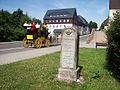
Kgl. Saxon. Milestone, station stone in Altenberg (Eastern Ore Mountains) with Kgl. Saxon. Stagecoach


Noteworthy is the work Geographia generalis (1650) by the geographer Bernhardus Varenius (Bernhard Varen, 1622–1650), who presented a general (global) and special (regional, local) geographical description in two parts.
The emergence of the maneuver strategy led in the 17th / 18th. Century for the formation of an engineer corps (France 1688, Brandenburg-Prussia 1729, Saxony 1730, Braunschweig 1731, Austria 1747), which was not exclusively, but mainly, dealing with geographical problems from a military point of view. Practical work such as B. the erection of the post mile pillars (from 1720), preceded the large topographical land survey in Saxony (1780-1811). War map archives were created: France 1688 - at the Depot de la Guerre, England 1791 - Ordonnance Survey, Prussia 1742 - Plankammer, Austria 1764 - topographical section of the war archive.

Measuring car from Zürner, Saxony, early 18th century, postage stamp (GDR) 1971, MiNr 1704

Zürner measuring car, Saxony, early 18th century, description of the museum, Lauenstein Osterzg.

Measuring car from Zürner, Saxony, early 18th century, Lauenstein Castle Museum Osterzg.
_1971,_MiNr_1704.jpg)


Much of the military-geographic literature of this time comes from Saxon authors who dealt with the advantages for the military use of the site. These include: August Gottlob Böhme (1793) - from 1750 teacher of mathematical and military knowledge at the Dresden Engineering Academy, Backenberg (1797), Johann Georg Lehmann (1765–1811) - inventor of the terrain hatching.
It was not until the end of the 18th century that military geography began to develop into a science.
Establishment of the military geographer. Discipline in German-speaking countries
In 1801, selected participants, including Carl v. Clausewitz (1780–1831), an academy for young officers of the infantry and cavalry formed. One of her teachers was Ludwig Müller (1734–1804), who, with his theory of terrain, is considered to be the founder of scientific military geography in German-speaking countries. In 1801 he switched from training flagjunkers at the Potsdam Engineering Academy and the Berlin Inspection School as a lecturer for cartographic problems, terrain theory and castrametation (castrometry, military storage) at this academy.
The enlargement of the standing armies and the expansion of the areas of action led to changes in the art of war. Ludwig Müller writes: "The war system, which before the introduction of the fixed soldier was operated only as a temporary craft, now received the reputation of an art."
In his work Die Terrænlehre (1807) he made a clear distinction between art and science: “[…] among the various subjects that this art of war encompasses, one soon chose this one to exercise his military acumen and so gradually emerged through continued diligence several centuries the individual teaching buildings that bear the name of War Studies. […] But about the Terræn, the basic science of most of the so-called parts of the art of war, no one has written anything coherent up to now. ” That was a clear indication of the claim to the independence of military geography and at the same time the close association with military science in the Follow-up time.
From his practical service in the troops, Ludwig Müller had gained experience with special and situation maps, which made values created "partly by human hands" (apartments, bridges, enclosures) usable for military terrain assessment.
A comparable assignment of terrain theory to the art of war can be found in 1793 by August Gottlob Böhme in Saxony. Regarding the methods of getting to know the country, he notes: “Knowledge of the country is one of the first and most distinguished pieces of the art of war, which can be reached in various ways: with the help of maps, through the report of the inhabitants, through your own visits and through the Hunt."
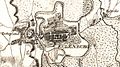
Plan EILENBURG (after 1764) by Isaak Jacob von Petri (1705–1776)

Friedrich Wilhelm Bauer (1731–1783), plans from Westphalen, Wallachey

Friedrich Wilhelm Bauer, Carte de la Moldavie, Map of Moldova


For the first time, maps (plans) appeared "for future use", ie for rooms in which no battles had previously taken place, but could take place. The situation plans by Isaak Jacob von Petri (1705–1776) for areas around Dresden, Meißen and Torgau and by Friedrich Wilhelm Bauer (1731–1783) for Westphalia, Moldau (1789) and Wallachey became particularly well known.
Statistics vs. Military geography, special geography in the 19th century.
According to Meyers Konversations-Lexikon of 1888/90, the further development of military-geographic work was strengthened by the general conscription : the larger the armies become and the more the war has become a national issue due to the general conscription (from 1813/14 in Prussia), the more effective it is the geographical conditions of the theater of war on the military operations and their preparation.
The practice at the General War School until the 1860s of showing military history and geography together resulted in the idea of permanent military geographic values, neglecting the current geographic conditions.
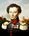
Carl von Clausewitz (1780–1831)

Building of the General War School in Berlin, Burgstr. 19, before 1883
Otto August Rühle von Lilienstern (1780–1847), director from 1837–1848 to d. General War school


The danger that military geography would become far removed from practice and become more scientific arose from the military geography contributions at the beginning of the 19th century. The strong introduction to the schematic-statistical description in the military-geographic literature by Carl von Clausewitz (1780–1831), who spoke of a "borrowed importance", received sharp criticism.
Otto August Rühle von Lilienstern (1780–1847), director of the General War School in Berlin from 1837 to 1848, criticized Carl August von Malchus' handbook of military geography for the same reason as being unusable for the officer.
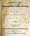
Yearbooks for Scientific Criticism, 1834, Volume 2, title page
Yearbooks for Science Critique, 1834, Vol. 2, SV, As. IX, No. 10
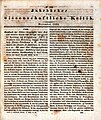
Jb. 1834 vol. 2, p. 874: Review by OA Rühle v. Lilienstern z. Handbook of Military Geography by CA v. Malchus


From 1850 to 1855, military geography for General Staff officers at the General War School in Berlin was renamed Special Geography .
Military geography went through a qualitative leap when Emil von Sydow (1812–1873), head of department in the General Staff, freed the subject from its exaggerated connection to military history. From 1865 on, Sydow experimented with photographic processes for card reproduction.
Albrecht TE von Roon (1803–1879), from 1824 to 1827 a student at the General War School in Berlin with the teacher of general geography Carl Ritter (1779–1859), led military geography out of its exaggerated connection to statistics in later years. Roon not only expanded the subject matter and theory of military geography, but also used political, economic and geographical features for assessing the practice in the Prussian-Austrian wars. Since Count von Roon, military geography can be seen as an independent, officially organized scientific discipline.

Emil von Sydow (1812–1873)

Albrecht TE von Roon (1803–1879)

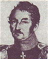
Eduard WH von Liebert (1850–1934)
M%C3%BCller_Carl_btv1b8453272j_(cropped).jpg)


General Eduard W. H. von Liebert (1850–1934) adopted Roon's ideas towards the end of the 19th century and gave practical recommendations for the officer in the descriptions. Significant achievements are attributed to Helmuth von Moltke (1800-1891), who also worked in personal union as an officer and geographer.
Military geography education at the General War School experienced a low point at the end of the 19th century. Albrecht von Roon had died in 1879 and some of his military-geographic ideas had been forgotten. With the teaching program of 1885, one of the latest campaigns had to be dealt with at the General War School, with the sole emphasis on the influence of the terrain on the operations. From 1894 a reduced number of hours was taught terrain rather than military geography.
Military geography and war geography at the beginning of the 20th century.
In the transition years of the 19th and 20th In the 19th century, the proportions in military geography changed in favor of a geography in the interests of the colonial section of the General Staff. The non-European elaborations were assigned to a newly emerging colonial geography. In the Great General Staff of 1913, the area of the chief land survey was reduced to the trigonometric, topographic, cartographic, photogrammetric departments and the colonial section and decoupled from the quartermaster positions.
Military geography experienced a rebirth in the run-up to and during the First World War as war geography , after special geography the second new name for military geography.

After the Treaty of Versailles and the dissolution of the German General Staff, the Reichswehr Ministry had a modest geographical and statistical department. The consequence is the complete discrediting of a war geography and the strong reduction of military geographic investigations. Until the beginning of the 1940s, it was limited to military-geographical and historical discussions. In the 1930s, the term defense geography emerged, the founder and most prominent representative of which is Oskar Ritter von Niedermayer (1885–1948).
Military geography vs. Defense geography, defense science, geopolitics
The third decade of the 20th century marked a third mutation for classic German military geography - via military geography to military geopolitics.
Oskar Ritter von Niedermayer, from 1933 Privatdozent for military teaching and defense policy at the Berlin University, explained: The term defense emerged from “German experience and German needs” after the First World War and “[...] includes the entire armament of the state and People and their area of life, the material and personal forces, the intellectual, economic and military, namely both the preparatory measures for peace and the deployment of forces in war. "
In a contribution to Petermann's Geographische Mitteilungen (1934), W. Schmoeckel turns away from Roon's views of a close connection between military geography and politics. In his opinion, there was "an acute practical need to continue to differentiate the terms military geography and defense geography, to leave military geography to strategy and tactics, and defense geography to politics."
Niedermayer followed suit and made a distinction: “Military geography is geography from a military point of view and defense geography is geography from the defense point of view. [...] Defense geography emerged from military geography. "
In 1936, at the Geographentag, Niedermayer presented his concept of military science . As branches he counted: Defense philosophy, defense history, defense law, defense economy, defense policy, general defense doctrine and defense geography. From 1937 he took over responsibility for the last three branches of science as director at the Institute for General Defense Studies at Berlin University. Regarding the assignment of defense geography to defense science, he came to the conclusion in 1942: "Just as war and defense belong in the field of politics, so defense geography is part of political geography."
Oskar Karl Haushofer (1869–1946) characterized the three terms military geography, defense geography and geopolitics differentiated according to his reading: “In the first two there is the description, thus latent recognition of yesterday's situation, the applicable law, in the last [defense geopolitics] the application of the will to military power [...]. "
Attempts up to the 1980s to explain military defeats on the basis of geographical conditions should be noted. B. in a study from 1981 by geography professor Rainer Mennel.
Military geography had changed its name several times (special geography, war geography, military geography), on the other hand the documents intended for military practice were always published under the designation military geographic information reports.
Military geology in the GDR
Military political and subject-specific basics for military geology in the GDR
In the states participating in the Warsaw Treaty, the areas of political geography , military geography , and military topography and military hydrography were strictly separated according to the specifications of the leading power, the USSR . In the National People's Army (NVA) of the GDR, a Soviet-style political geography was dispensed with. A comprehensive account of the history of the state geography of the GDR is still pending. The monograph Military Geography of the GDR by the Federal Ministry of Defense (Vienna, 2006) describes and assesses the development of military geography, military topography and sea hydrography in the GDR. By means of comprehensive documentation, it primarily evaluates the work and performance of the Military Topographical Service (MTD) of the NVA and the Sea Hydrographic Service (SHD) of the GDR and provides more detailed explanations using numerous map examples.
The evaluation judgment is that in the armies of the participating states of the Warsaw Treaty technically excellent topographical and thematic maps have been developed, which are particularly impressive due to their usability for troops, uniformity of representation and the extent of the processing.
Since the military geographic documents and the entire surveying and mapping system and especially the thematic special maps were subject to very strict secrecy, little is known about the products of the MTD and SHD in the public and abroad. The monograph therefore contains an extensive list of abbreviations as well as the comparison (the synopsis) of the specialist terms East-West.
No foreign area was shown on the topographic map editions for the national economy TK (AV). In addition, objects of military and defense importance (OMV) were not shown in accordance with reality for security reasons. This is also common practice in NATO and EU member states, e.g. B. for military airfields and fixed radar systems.
Military geographical jurisdiction of the GDR

From 1976 a world map 1: 2,500,000 was available for military-geographic work, which had been drawn up jointly by seven participating states of the Warsaw Treaty (Bulgaria, GDR, ČSSR, Poland, Romania, Hungary, USSR). The GDR took over the processing of areas in North, West and Southwest Europe as well as on the South American continent (see illustration of world map - light yellow background).
The publication of the second edition could no longer be completed in 1990/91. The military-geographical areas of responsibility probably covered the areas that corresponded to the area of responsibility for topographical-cartographic provision agreed in the military alliance. This included selected areas of special military interest in the Western Theater of War (WKSP) in defined strategic areas and likely directions of operation, including:
- the territory of the GDR;
- the territory of West Berlin and the FRG (from 50 ° N to 54 ° 40'N);
- the Netherlands and Belgium, Luxembourg (west 6 ° E and north 50 ° N), France (north 48 ° and 0 ° to 6 ° E).
The military geographers were not members of the MTD, but general staff and troop officers. Their elaboration was based on extremely extensive and detailed information that was obtained from the chief of the reconnaissance area in the main staff of the National People's Army of the GDR through the evaluation of relevant documents and through targeted explorations in the area by experts in military overseas reconnaissance.
Military geographic information documents in the GDR
As a result, from 1981 the main staff of the NVA had a military geographic information document on the western theater of war (MAD-WKSP) and 11 special map series.

As a maritime supplement, the Military Geographical Information Document of the People's Navy (MGAD-VM) was drawn up by the Sea Hydrographic Service of the GDR in accordance with the specifications of the main staff of the NVA from 1976 to 1985 . The loose-leaf collection comprises defined geographical areas in several volumes:
- Volume 1 - German Bight and Western Coastal Waters of Denmark;
- Volume 2 - Skagerrak;
- Volume 3 - Sound and Belt Zone northern part (Kattegat);
- Volume 4 - Sound and Belt Zone, southern part (Belt Sea);
- Volume 5A - Coast of the GDR;
- Volume 5B - Vorsundzone (FRG, Denmark, Sweden).
From 1986 to 1989, the military academy "Friedrich Engels" in Dresden compiled military-geographic information about France, Great Britain, Spain and Portugal and subsequently adapted the cartographic part to the information document MAD-WKSP.
Series of publications on military geography in the GDR
The change in global politics from the mid-1980s onwards made it possible to partially disclose the results of theoretical-military-geographic research at the "Friedrich Engels" military academy and to publish the military geography series of the Ministry of National Defense.

Title page, Military Geography Series, H. II / 2, (Ed.) MfNV, 1989
Former Military Academy "Friedrich Engels", Dresden (around 1988)
Topographic map edition for the economy in the GDR

.jpg)
.jpg)
From 1988 to 1990 a total of 21 military geographic and military geographic issues were published in the military geography series, issues I to XII (issue, title, year of publication).
- I On theoretical questions in military geography, 1988, 64 p., 5 fig.
- II / 1 Outline of the history of military geography from the slave-holding order to the end of the 18th century, 1989, 48 pp.
- II / 2 Outline of the history of military geography from the 19th century to the end of World War II, 1989. 72 pp.
- III / 1 Military Geographic Working Methods. Guide for the development of military geographic information documents, 1988. 40 p., 3 fig.
- III / 2 Military Geographic Working Methods. Theoretical Foundations, 1988. 40 p., 6 fig.
- IV Description and assessment of military geographic regions, 1990. 80 p., 7 fig.
- V The ocean. A consideration from a military geographic point of view, 1989. 72 p., 4 annexes.
- VI / 1 Military Geographical Description of the Federal Republic of Germany, Part 1, 1988. pp. 1–64, 10 Fig.
- VI / 2 Military Geographical Description of the Federal Republic of Germany, Part 2, 1988. pp. 65–136, 14 Fig.
- VII / 1 Military Geographical Description of Belgium. Netherlands, Luxembourg, part 1: Belgium, 1989, pp. 1–80, 1 fig.
- VII / 2 Military Geographical Description Belgium, Netherlands, Luxembourg, Part 2: Netherlands, Sections 1 to 3, 1989, pp. 81–136, 4 fig.
- VII / 3 Military Geographical Description Belgium, Netherlands, Luxembourg, Part 3: Netherlands, Sections 4 and 5, 1989, pp. 137–204.
- VII / 4 Military Geographical Description Belgium, Netherlands, Luxembourg. Part 4: Luxemburg und Anlagen, 1989. pp. 20–276, 1 fig., 15 annexes.
- VIII Military Geographical Description of France, 1988. 64 p., 17 fig.
- IX Military Geographical Description Great Britain, 1988. 64 p., 17 fig.
- X / 1 Military Geographical Description of the Baltic Sea Exits: Description of the Sea Areas, 1988, 68 pp., 5 Fig.
- X / 2 Military Geographical Description of the Baltic Sea Exits: Description of Denmark, 1988, 52 pp., 1 Fig.
- X / 3 Military Geographical Description of the Baltic Sea Exits: Description of Sweden, 1988, 68 pp.
- X / 2 Military-geographical description of the Baltic Sea exits: Description of Schleswig-Holstein, 1988, 68 pages, 10 appendices.
- XI Military Geographical Description. The German Bay and the western coastal waters of Denmark. 1988, 68 pp., 5 ills.
- XII Military Geographical Description. Skagerrak Norway ,. 1990, 96 pp., 13 ills.
In the Federal Archives-Military Archives Freiburg i. Br. The booklets of the military geography series are available.
Content of the military geography area
The booklets on the subject of military geography were structured uniformly, presumably in line with the information document:
- Introduction, general geographic conditions (geographic location, area and spatial extent, boundaries); Physico-geographical conditions (relief, soil vegetation and properties, hydrogeography, coasts and islands, climate);
- Political-geographical conditions (administrative structure, state structure, political parties and mass organizations, mass media, population and settlements);
- Economic-geographical conditions (general characteristics of the economy, mineral resources, energy economy, industry, agriculture, foreign trade);
- Operational expansion (road network, railway network, inland waterway network, sea ports and jetties, pipeline network, airport network, communications network, command posts, missile positions, operational blocking system, barracks and military training areas, military camps, health care);
- Military geographic significance, bibliography.
In the Federal Archives-Military Archives Freiburg i. Br. Further study materials of the military academy "Friedrich Engels" on military geography are available.
Explanations of geographical technical terms
Geographical factors and geocomplex
The following sections provide an insight into the (military) geographic world of terms in the GDR, published in issue 1 of the military geography series (1988).
Geographical factors is the designation for those geographical facts which, in diverse interplay, determine the characteristic features of the individual geographical regions and landscapes. Physical-geographical factors are e.g. B. certain phenomena of the climate. the hydrosphere, the soils and the flora, relief forms as well as geological facts that influence the formation, weathering and soil formation.
The causal connection of the individual geographical factors (physical, political and economic-geographical factors) exists at all points on the earth's surface and is referred to in geography as a geographical connection.
Geographical complex (geocomplex) is the general name for integrated geographical units, as distinct from individual geographical factors. The term geocomplex can be used for a specific section of the earth's surface, it can be typological, it can also refer to sub-complexes (physical, political, economic-geographical) or spatial structures. He always expresses the integration of elements and relations into a system. Special terms such as physiotope or ecotope are used for the geocomplexes of different content. The analysis of geocomplexes requires complex analysis as a special method.
Geographical conditions and geographical milieu
Geographical conditions are the sum of the geographical factors. A distinction is made between general, physical, political and economic-geographical conditions as well as the operational expansion of a space.
From the geographical conditions, military-geographical conditions are defined according to a military evaluation.
Geographical milieu describes the totality of the geographical conditions on the earth's surface with which human society has to deal.
The term would be too narrow if it were restricted to the natural elements, because nature has been transformed in many ways through the millennia of human activity. The conditions of the geographical milieu include the works of man. The cultural landscape forms the geographical milieu of the human being, while the national nature only makes up part of the milieu conditions.
Geography, from the point of view of many other sciences, has the task of researching the geographical milieu.
Military geographic factors and conditions
Military geographic factors represent a complex of those geographic factors which are characteristic of a militarily determined area and which influence the preparation and implementation of actions by the armed forces, including armed struggle.
Military -geographical conditions are those political, economic and physical-geographical characteristics of a state or a theater of war that influence the preparation and conduct of actions by the armed forces, including armed struggle.
Operatively and tactically which form the earth's surface according to Bodenbewuchs classified as open, covered, heavily covered; according to a determining influence on the movements in not cut through, cut through and strongly cut through, in flat terrain or mountains , in rivers and swamps. The climate , the season and the distribution of the population , the building fabric (urbanity) and the infrastructure are important for the combat force and the supply of ground-based troops. In the past, the cultivation conditions of agriculture for a land-based supply of the armed forces were important.
In conventional warfare , the interaction between armed forces and diplomacy is important, as are general political conditions, the course of state borders and popular mood. Since these conditions change over time and region, the study of military geography follows on given political and strategic situations. The influence of the technical infrastructure and the mass media is also not insignificant . From a historical perspective, military geography should be adequately integrated into the history of wars.
Definitions of military geography in the changing times
Universal Lexicon - 1890
Military geography
"Military geography [is] the geography that regards countries not only in general terms, but also in terms of the importance they have for the conduct of war. Hence the products of a country, insofar as they are important to a war army, the more or less warlike spirit of the inhabitants and the like. above all the nature of the land for war use, the terrain within the range of the M. their flattening into a hilly area u. finally in the plain, the course of the rivers, their navigability, the streets and the like. Railways, the points where they reach mountains and Crossing rivers (passes), the nature of the bridges, the objects that can promote a war operation in any way, hence forests, land very much intersected with hedges, swamps, ditches, etc., especially things that occur in the river. In cities and Villages pays particular attention to their type of construction, whether churches, monasteries, castles or other buildings are suitable in them, especially for the creation of magazines, lazareths or other military establishments, whether the occupation of the residents (trade, factories) the localities for such systems makes suitable, u. Above all, the ability of the places to fortify them, as they take into account the existing fortresses, and the like. seeks to judge their military importance. The knowledge of the most important battlefields is sometimes taken with it in a broader sense. Cf. Hahnzog, Lehrbuch der M. in Europa, Magdeb. 1820-1823, 2 vol .; Meinecke, General Textbook of Geography for Military Schools etc., 3rd ed., Magdeb. 1836; Koller, Kleine M. von Europa, Vienna 1855; Killmeyer, M. von Europa, Stuttg. 1856. "
German Military Lexicon - 1961
Military geography - Военная география
“Branch of military science that studies the modern state of the political, economic, military and geographical indicators of the various countries and theaters of war from the point of view of their influence on the preparation and conduct of combat operations and the war as a whole. The M. consists of two main branches: the military geography and the description of the theaters of war. "
German Military Lexicon - 1962
Military geography
"[...] is a military-scientific discipline that describes the political-geographical, economic-geographical and physical-geographical conditions as well as the operational expansion of the territory of a possible theater of war (ie its preparation for the conduct of combat operations in the event of war) with regard to their influences researches the preparation and conduct of combat operations. The results of such military-geographic investigations are made available to the command organs and troops of the armed forces in the form of verbal military-geographic descriptions or special military-geographic maps. "
Military Lexicon of the GDR - 1973
Military geography
is a "discipline of military science that researches the political, economic and physical-geographical conditions as well as the operational expansion of the territory of the various states and theaters of war with regard to their possible influences on the preparation and implementation of the armed struggle.
The results of such military-geographic investigations are made available to the command organs and troops of the armed forces in the form of verbal military-geographic descriptions or special military-geographic maps. "
Military Encyclopedia Dictionary (Russian) - 1986
Military geography
as “a special branch of science in geography examines the current military-political, military-economic and natural conditions as well as the operational expansion of theaters of war, individual countries, strategic areas and directions as well as their influence on the preparation and implementation of wars (military actions). It is closely related to military science. It is subdivided into the general principles, in which the content and tasks of military geography are determined, military geography and the study of the theaters of war. "
Russian Online Encyclopedia - 2019
Military geography
is a special branch of geography and researches the political, economic and military possibilities of the states (coalition states), the natural conditions and their influence on the preparation and implementation of wars (combat operations). It includes military geography and the geography of the theaters of war.
Trivia
In Tienshan there is a 6873 m high mountain called Pik der Military Topographers (in western spelling: Pik Voennykh topographov), over which the border between Kyrgyzstan and China is drawn. This is said to have been climbed for the first time in 1965 by a group led by A. Vododokhov.
See also
- Military Geography Institute
- Office for Military Geosystems
- Research relay e.g. V.
- Military Geographic Institute in Switzerland
literature
- Military Dictionary (American), DOD Dictionary of Military Terms, Department of Defense (DOD) USA. In: Joint Publication (JP) 1, issue As of February 2019. Retrieved on March 1, 2019 from URL:
- Gerhard L. Fasching (head of the collective of authors), Peter Bauer, Hans-Ludwig Ewert , Werner Gillessen, Thomas Palaschewski, René Pfahlbusch, Herbert Scharlo, Roland Schunk, Klaus Schwerdtfeger: Military geography of the GDR. Military geography, military topography, military hydrography, military topographical service, sea hydrographic service, topographic maps, special and sea maps in the German Democratic Republic, from the beginnings to reunification. (Ed.) Federal Ministry for National Defense: Series of publications by the military geography, No. 20, Vienna 2006, December, 237 pages, 17 annexes.
- Keyword: military geography . In: Meyers Großes Konversations-Lexikon . 6th edition. Volume 13. Leipzig 1908, p. 817 ( online at zeno.org)
- Arnold Keller, Georg Imhof: Military geography of Switzerland and its border areas. Upper Valais sector 1911 . ISBN 3-8334-2817-1 .
- Barré: La geographie militaire et les nouvelles méthodes géographiques: Introduction à l'étude de l'Europe centrale . Nancy 1899.
- Barré: La France du Nordest . Nancy 1899.
- Maguire: Outlines of military geography . Cambridge 1899.
- Pramberger: Makeshift for studying the military geography of Central Europe . 3. Edition. Vienna 1899.
- Pramberger: Atlas etc. Vienna 1894.
- Porro: Guido allo studio della geografia militare . Turin 1898.
- Stavenhagen: Military geographical sketches of the theaters of war in Europe . Berlin 1898.
- Marga: Géographie militaire . 4th edition. 1st department: France. Paris 1885 (2 volumes).
- Marga: Géographie militaire . 2nd Dept .: the other states of Europe. Paris 1885 (3 volumes).
- Pica: France and Germany, a parallel . 6th edition. Hamburg 1882.
Individual evidence
- ↑ Author collective: Military Lexicon . 2nd edition, Military Publishing House of the GDR, Berlin 1973, p. 234 .
- ↑ Author collective: Military Lexicon . Military Publishing House of the GDR, Berlin 1962, p. 405 .
- ^ Thomas Palaschewski: Political geography and military geography in the participating states of the Warsaw Treaty . In: Gerhard L. Fasching, Federal Ministry for National Defense (Hrsg.): Military Geosystems of the GDR, series of publications of the Military Geosystems . No. 20 . Vienna December 2006, p. 188-191 .
- ^ Rolf Krauspe, Hans-Ulrich Suthau, Horst Zimmermann: On theoretical questions of military geography . In: Jürgen Holzhüter, MfNV (Ed.): Series of publications on military geography . Issue 1. Strausberg 1988, p. 1 f .
- ^ Rolf Krauspe, Hans-Ulrich Suthau, Horst Zimmermann: On theoretical questions of military geography . In: Jürgen Holzhüter, MfNV (Ed.): Series of publications on military geography . Issue 1. Strausberg 1988, p. 40 ff .
- ↑ Ssun – Ds': Treatise on the art of war . Trans. A. d. Old Chinese into Russian, German translation. Publishing house of the Ministry for National Defense, Berlin 1957.
- ^ Ludovico Guiccardini: De idyllische Nederlanden . (ndl)., first edition, Antwerp 1567. In: Description of the Netherlands . Basel 1580.
- ^ Bernhardus Varenius ,: Geographia generalis . (lat.), Amstelodami 1650, 1664, transl. (German). In: Carl Rohrbach (Ed.): A piece from Bernhard Varenus' Allgemeine Geographie . Gotha 1888.
- ^ Rolf Krauspe, Hans-Ulrich Suthau, Horst Zimmermann: On theoretical questions of military geography . In: Jürgen Holzhüter, MfNV (Ed.): Series of publications on military geography . Issue 1. Strausberg 1988, p. 31 ff .
- ↑ Ludwig Müller: The Terrænlehre . With coppers and woodcuts. In: Ludwig Müller's posthumous military writings . Second volume. Berlin 1807, p. 3 .
- ↑ Ludwig Müller: The Terrænlehre . With coppers and woodcuts. In: Ludwig Müller's posthumous military writings . Second volume. Berlin 1807, p. 4 f .
- ↑ Ludwig Müller: The Terrænlehre . With coppers and woodcuts. In: Ludwig Müller's posthumous military writings . Second volume. Berlin 1807, p. 17 .
- ↑ August Gottlob Böhme: Treatise like a whole country with all its objects and divisions by means of geometrical and astronomical observations and to present them geographically on a map . Dresden 1793, p. 38 and 207 f .
- ↑ Isaak Jacob von Petri: Gantz New And Complete Geographical General Charte Vom Gantzen Churfürstenthum Sachsen . Berlin, after 1764.
- ↑ Carte de la Moldavie: pour servir a l'histoire militaire de la guerre entreles Russes etles Turcs . Amsterdam 1781.
- ^ Carl von Clausewitz: From the war . Left work by General Carl von Clausewitz. Third book, first chapter. Verlag des MfNV, Berlin 1957, p. 163 .
- ↑ Otto August Rühle v. Lilienstern: [criticism of the] manual of military geography, or geography and statology of Europe with special reference to warfare . From Carl August v. Malchus. With an oro-hydrographic map of Europe, Heidelberg and Leipzig 1833. In: Yearbooks for Scientific Criticism (1827–1846), December 1834 . Volume 2, No. 103/104 . Berlin 1834, p. 874-884 .
- ^ Rolf Krauspe: Development and importance of military geography in the art of war . In: Ministry for National Defense of the GDR (ed.): Series of publications on military geography . Book 2, part 2. Strausberg 1988, p. 16 ff .
- ↑ Albrecht v. Roon: The Iberian Peninsula, a monograph from the point of view of the military (1839) . and On the Purpose and Concept of Military Geography (1857). Berlin 1839.
- ^ Rolf Krauspe: Development and importance of military geography in the art of war . In: Ministry for National Defense of the GDR (ed.): Series of publications on military geography . Book 2, part 2. Strausberg 1988, p. 31 .
- ^ Eduard W. H. von Liebert: The Polish theater of war . Military geographic study. In: Sarmaticus . 2 vols. Hannover 1880, p. III .
- ^ Rolf Krauspe: Development and importance of military geography in the art of war . In: Ministry for National Defense of the GDR (ed.): Series of publications on military geography . Book 2, part 2. Strausberg 1989, p. 19 ff .
- ^ Rolf Krauspe: Development and importance of military geography in the art of war . In: Ministry for National Defense of the GDR (ed.): Series of publications on military geography . Book 2, part 2. Strausberg 1989, p. 21 .
- ↑ Oskar Ritter von Niedermayer: Defense geography . Berlin 1942, p. 103 .
- ^ W. Schmoeckel: Military Geography - Defense Geography . In: Series Petermanns Geographische Mitteilungen, 80th year . Jena 1934, p. 371 f .
- ↑ Oskar Ritter von Niedermayer: Defense geography . Berlin 1942, p. 7 and 9 .
- ↑ Oskar Ritter von Niedermayer: Defense geography . Berlin 1942, p. 8 .
- ^ Karl Haushofer: Defense geopolitics . In: Yearbook of the German Society for Defense Policy and Defense Sciences - 1934. Through military ability to peace . Hamburg 1934, p. 54 .
- ↑ Rainer Mennel: The final phase of the Second World War in the West (1944/45) . A study of political geography. In: Studies on military history, military science and conflict research . tape 27 . Osnabrück 1981, p. 346 f .
- ↑ KI Spidtschenko (Red.), KA Koslow u. a .: Political and military geography . Translation a. d. Russ., Gerd Fröhlich, Friedel Bösherz. . 1st edition, 345 S. Berlin 1977 (Original title: Политическая и военная география:.. Учебное пособие для курсантов высш воен.-полит училищ Сов Армии и Воен.-Мор Флота, под общ ред полк К...... И. Спидченко, Москва 1974, 343 с., Карт. ).
- ^ Author collective: Military geography of the GDR . Military geography, military topography, military hydrography, military topographical service, sea hydrographic service, topographic maps, special and sea maps in the German Democratic Republic, from the beginnings to reunification. In: Gerhard L. Fasching, Federal Ministry for National Defense (Hrsg.): Series of publications of the military geospatial, No. 20 . Vienna December 2006, p. 237 pp., 17 annexes .
- ^ Author collective: Military geography of the GDR . Summary. In: Gerhard L. Fasching, Federal Ministry for National Defense (Hrsg.): Series of publications of the military geospatial, No. 20 . Vienna December 2006, p. 11 .
- ↑ Gerhard L. Fasching, Rene Pfahlbusch: The state geography of the GDR . In: Gerhard L. Fasching, Federal Ministry for National Defense (Hrsg.): Series of publications of the military geospatial, No. 20 . Vienna December 2006, p. 25 ff .
- ↑ Gerhard L. Fasching, Rene Pfahlbusch: The state geography of the GDR . In: Gerhard L. Fasching, Federal Ministry for National Defense (Hrsg.): Series of publications of the military geospatial, No. 20 . Vienna 2006, p. 26th ff .
- ↑ Gerhard L. Fasching, Rene Pfahlbusch: The state geography of the GDR . In: Gerhard L. Fasching, Federal Ministry for National Defense (Hrsg.): Series of publications of the military geospatial, No. 20 . Vienna December 2006, p. 22 f., Appendices 5 and 6 .
- ↑ Gerhard L. Fasching, Rene Pfahlbusch: The state geography of the GDR . In: Gerhard L. Fasching, Federal Ministry for National Defense (Hrsg.): Series of publications of the military geospatial, No. 20 . Vienna December 2006, p. 28 ff .
- ↑ Rene pile Busch: The Seehydrographische service of the GDR . The nautical-hydrographic security of the People's Navy and the supply of nautical documents. In: Gerhard L. Fasching, Federal Ministry for National Defense (Hrsg.): Series of publications of the military geospatial, No. 20 . Vienna 2006, p. 162 ff .
- ^ Gerhard L. Fasching, Rene Pfahlbusch: The topographical-geodetic security of the land and air forces of the NVA and the border troops of the GDR . In: Gerhard L. Fasching, Federal Ministry for National Defense (Hrsg.): Series of publications of the military geospatial, No. 20 . Vienna December 2006, p. 75 f .
- ↑ Gerhard L. Fasching, Rene Pfahlbusch: The state geography of the GDR. In: Federal Ministry for National Defense (Hrsg.): Series of publications of the military geography . No. 20 . Vienna 2006, p. 32 f .
- ^ Rolf Krauspe, Hans-Ulrich Suthau, Horst Zimmermann: On theoretical questions of military geography . In: Horst Holzhüter, Ministry for National Defense of the GDR (ed.): Military geography series, booklet 1 . Strausberg 1988, p. 55 f .
- ^ Rolf Krauspe, Hans-Ulrich Suthau, Horst Zimmermann: On theoretical questions of military geography . In: Horst Holzhüter, Ministry for National Defense of the GDR (ed.): Military geography series, booklet 1 . Strausberg 1988, p. 56 .
- ↑ Author collective: Military Lexicon . 2nd Edition. Berlin 1973, p. 234 .
- ↑ military geography . In: Heinrich August Pierer, Julius Löbe (Hrsg.): Universal encyclopedia of the present and the past. 4th edition, volume 11 . Altenburg 1860, p. 263 .
- ↑ military geography . In: Heinrich August Pierer , Julius Löbe (Hrsg.): Universal Lexicon of the Present and the Past . 4th edition. tape 11 . Altenburg 1860, p. 263 ( zeno.org ).
- ↑ Collective of the Military Academy of the National People's Army "Friedrich Engels": German Military Lexicon. Berlin 1961, p. 271 f.
- ↑ Author collective: German Military Lexicon . Berlin 1962, p. 405 .
- ↑ Author collective: Military Lexicon . 2nd Edition. Berlin 1973, p. 234 .
- ↑ Military Encyclopedia Dictionary (Russian): Военный Энциклопедический Словарь . Moscow 1986, p. 186 .
- ↑ (Online) encyclopedia of the Ministry of Defense of the USSR, transl . Ad Russ., Orig .: Военная Энциклопедия Минобороны России . Moscow 2019 ( mil.ru [accessed January 23, 2019]).
- ↑ Yevgeni Grippenreiter, Vladimir Shataev: Six and Seventhousanders of the Tien Shan and the Pamirs , p. 4, see also: http://www.alpinejournal.org.uk/Contents/Contents_1996_files/AJ%201996%20122-130%20Gippenreiter % 20USSR.pdf