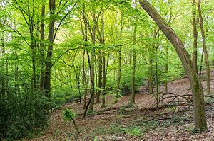
Mintard mountain
| Mintard mountain | ||
|---|---|---|
|
Mintarder Ruhrtalhang and Mintarder Berg nature reserve |
||
| height | 116 m | |
| location | North Rhine-Westphalia , Germany | |
| Coordinates | 51 ° 22 '10 " N , 6 ° 53' 52" E | |
|
|
||
| Development | Trails and roads | |
The Mintarder Berg is an elevation in Mintard , a district of Mülheim an der Ruhr . The mountain is 116 m high and represents the eastern border of the Ruhr Valley .
location
The Mintarder Berg is part of the Ruhr heights on the Lower Ruhr. The summer mountain south m is higher while the northerly 121 than the Mintarder Berg Auberg achieved m a height of 106th The western flank of the Mintarder Berg drops steeply into the Ruhr valley.
natural reserve
The area around the mountain has been protected as the Mintarder Ruhrtalhang and Mintarder Berg nature reserve since 2005 . The nature reserve covers 28.9 hectares .
hike
The Mintarder Berg is crossed by numerous hiking trails that run, for example, via Ratingen-Hösel , Laupendahl and the Mintarder Ruhrtalbrücke .
Individual evidence
- ↑ Google Maps. Retrieved August 3, 2018 (de-US).
- ↑ Cycling and hiking map of Düsseldorf and the surrounding area .
- ↑ LANUV NRW 2013: Nature reserves and Eifel National Park in NRW - Specialized information - Area lists - Total nature reserves - NSG Mintarder Ruhrtalhang and Mintarder Berg. Retrieved August 3, 2018 .
- ^ Breitscheid, Mintarder Berg and Landsberger Busch - Berg-Mark-Wege.de. Retrieved on August 3, 2018 (German (Sie-Salutation)).

