Moala Group
| Moala Group | ||
|---|---|---|
| Waters | Koro lake | |
| archipelago | Lau Islands | |
| Geographical location | 18 ° 52 ′ S , 179 ° 55 ′ E | |
|
|
||
| Number of islands | 3 | |
| Main island | Moala | |
| Total land area | 147.5 km² | |
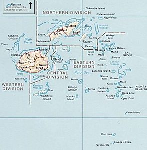
| Map of Fiji with the Moala Group | ||
The three most south-westerly, somewhat remote, islands of the Lau Islands in the Pacific Ocean are referred to as Moala Group (Eng. "Moala Group"), more rarely Moala Islands . Politically, the archipelago belongs to the Eastern Division of the island state of Fiji .
geography
The group is located 110 km west of Lakeba and 160 km south of Suva in the south of the Koro Sea. The Moala Group includes the three comparatively young atolls Moala in the north, Totoya in the middle and Matuku in the south. The total area of all islands is 147.5 km², with Moala being the largest with 62.5 km² and Totoya the smallest with an area of 28 km². The highest point is the Delaimoala at 468 m above sea level on Moala. The 180th degree of longitude cuts through the Moala Group between the islands of Moala and Totoya.
Web links
- The Moala Group on govisitfiji (English)

