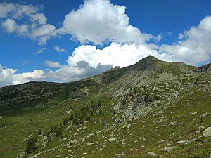
Mont Noble (mountain)
| Mont Noble | ||
|---|---|---|
|
Mont Noble seen from the west |
||
| height | 2673 m above sea level M. | |
| location | Canton of Valais , Switzerland | |
| Mountains | Valais Alps | |
| Dominance | 1.08 km → Mont Gautier | |
| Notch height | 144 m ↓ Col de Cou | |
| Coordinates | 604004 / 117 337 | |
|
|
||
The Mont Noble is a mountain above the village of Nax in the Swiss canton of Valais and has an altitude of 2673 m above sea level. M. It is located between the Val d'Hérens in the west and Val de Réchy in the east.
A chairlift has been running from Nax to the Dzorniva middle station since 1979 . From there, 2 additional, fixed-grip chairlifts and 1 ski lift on the west side of Mont Nobles open up a small ski area with 30 km of marked ski slopes.
Web links
Commons : Category: Mont Noble - album with pictures, videos and audio files

