Monte Gelbison (Campania)
| Monte Gelbison | ||
|---|---|---|
|
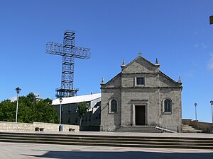
Church and summit cross |
||
| height | 1705 m slm | |
| location | Italy , province of Salerno | |
| Mountains | Southern Sub-Apennines | |
| Coordinates | 40 ° 13 ′ 0 ″ N , 15 ° 19 ′ 0 ″ E | |
|
|
||
| Normal way | Street | |
|
View to the south |
||
The Monte Gelbison , which is also called Monte Sacro (Italian: holy mountain), is one of the highest mountains in the Cilento with a height of 1705 m slm .
geography
The mountain is enclosed by the towns of Cannalonga , Ceraso , Novi Velia , Cuccaro Vetere , Futani , Laurito , Montano Antilia , Rofrano and Vallo della Lucania . When the weather is good, it offers a beautiful panorama with the southern Italian coast as far as Sicily and the Aeolian Islands . To the north you can see Vesuvius . At the top is the Sanctuario della Madonna di Novi Velia , one of the most popular pilgrimage sites in Campania. The "Black Madonna" in the sanctuary founded by Basilican monks is probably of African origin.
reachability
A road leads to Monte Gelbison, which begins in Novi Velia and leads up to the mountain in about 10 km. There are also hiking trails starting from the surrounding villages. The hike on foot takes about 5 hours and is a special experience, especially during the pilgrimage dates in May and September. Strict traditionalists also take this path barefoot. Many take a stone with them on the way, which they then put in a pile up in front of the stairs to the monastery.
Individual evidence
- ↑ Gabriella Vitiello - Frank Helbert: Naples - Amalfi Coast - Cilento . 2001, p. 198 .


