Titano
| Monte Titano | ||
|---|---|---|
|
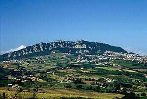
View from the east. The large village on the right edge of the picture below the steep wall is Borgo Maggiore . The fortress La Guaita, which forms the city center of San Marino , can be seen on the ridge above . |
||
| height | 739 m slm | |
| location | San Marino | |
| Mountains | Apennines | |
| Dominance | 17.55 km → Testa del Monte | |
| Notch height | 189 m ↓ | |
| Coordinates | 43 ° 56 '6 " N , 12 ° 27' 0" E | |
|
|
||
| particularities | Highest mountain in San Marino | |
|
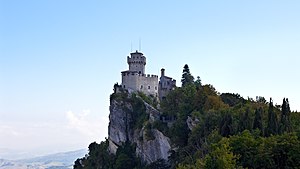
One of the three defense towers of Monte Titano |
||
|
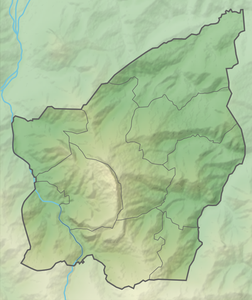
Location of Monte Titano in San Marino |
||
At 739 meters, the Titano is the highest mountain in San Marino and with its three peaks it dominates the green hilly landscape there.
Location and surroundings
The central area of San Marino is almost completely traversed roughly in a north-south direction by the seven kilometer long limestone ridge of Monte Titano, which slopes steeply to the east. The city of San Marino is located on the mountain.
In 2008 the city was named a World Heritage Site by UNESCO . The 55 hectare area of the hilltop and the cliffs lies entirely within the protected zone.
Web links
Individual evidence
- ↑ a b Monte Titano on Peakbagger.com (English), accessed on September 12, 2015.
- ↑ Itinerari naturalistici: La Rupe del Monte Titano. In: visitsanmarino.com. Ufficio del Turismo, accessed on November 7, 2015 (Italian, description of a hiking trail to the summit of Monte Titano with altitude information).


