Mount Alberta
| Mount Alberta | ||
|---|---|---|
| height | 3619 m | |
| location | Alberta (Canada) | |
| Mountains | Canadian Rockies | |
| Dominance | 6.85 km → North Twin (Twins Towers) | |
| Notch height | 779 m ↓ Woolley Shoulder (2840 m) | |
| Coordinates | 52 ° 17 '14 " N , 117 ° 28' 36" W | |
| Topo map | Sunwapta Peak 83 C / 6 | |
|
|
||
| First ascent | July 21, 1925 Yūkō Maki, Hans Kohler and team |
|
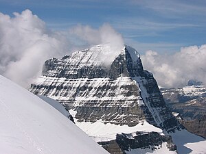
The Mount Alberta is a 3619 meter high mountain in Jasper National Park in the Canadian province of Alberta . It is one of the highest peaks in the Canadian Rockies .
geography
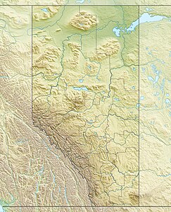
Mount Alberta is north of the Columbia Ice Field , on the eastern bank of the Athabasca River . It forms the highest point of the Sir Winston Churchill Range .
Naming
The mountain, like the province of the same name, was named after Princess Louise Caroline Alberta of Great Britain and Ireland , a daughter of the British Queen Victoria .
Ascent history
The first ascent took place on July 21, 1925 by the Japanese climbers Maki Yūkō , Seiichi Hashimoto, Masanobu Hatano, Tanezo Hayakawa, Yukio Mita and Natagene Okabe, as well as by the Swiss mountain guides Heinrich Fuhrer, Hans Kohler and Jean Weber. The ascent of Mount Alberta is very demanding and is characterized by a high degree of difficulty.
Web links
- Mount Alberta at Peakware (English)
- Mount Alberta, Alberta on Peakbagger.com (English)
Individual evidence
- ↑ a b Mount Alberta. Peakware, accessed on August 11, 2017 .
- ↑ Conquering Mount Alberta, 1925. Alpina Americana, 1953, accessed on August 11, 2017 (English).
- ^ Heinrich Fuhrer. Summit Search, accessed August 11, 2017 .

