
Mount Hillaby
| Mount Hillaby | ||
|---|---|---|
| height | 340 m | |
| location | Barbados | |
| Coordinates | 13 ° 12 '42 " N , 59 ° 34' 53" W | |
|
||

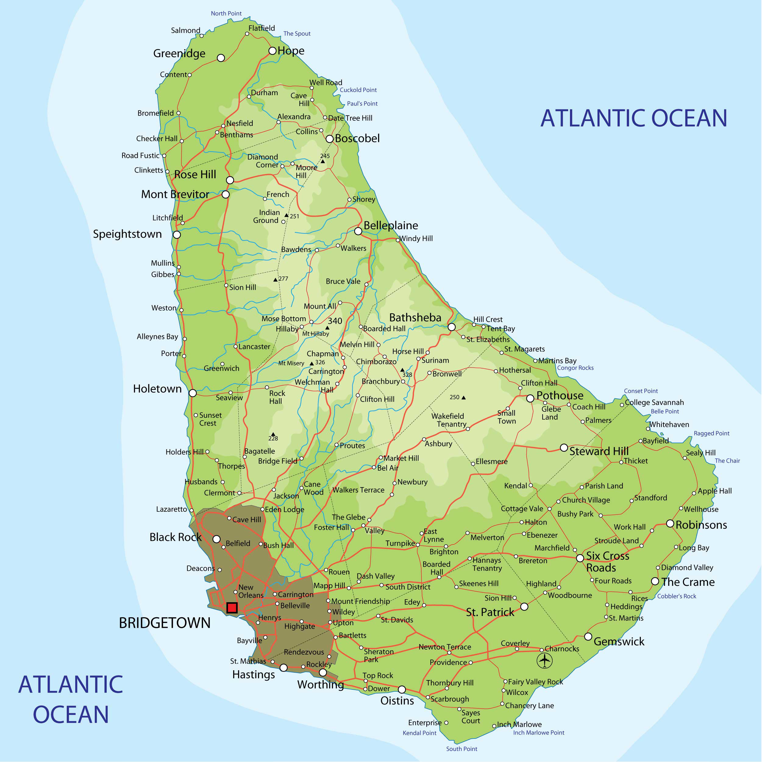
With a height of 340 m, Mount Hillaby is the highest point in the Caribbean island state of Barbados .
Location and surroundings
The mountain lies to the east to the west of the Parish of Saint Andrew . Places in the vicinity are Hillaby and Mose Bottom in the west as well as Mount All in the northeast and Chapman in the southeast. It is located in the Scotland district , one of the most pristine and most sparsely populated landscapes on the island, which, in contrast to the otherwise heavily used island, is important because of its thick forest and its geological peculiarities.
geology
Although not a volcano itself, Mount Hillaby is the highest point of an extensive volcanic system several hundred kilometers long, most of which is located below sea level, between Puerto Rico and Trinidad . It is an accretion wedge that was created by the meeting of the Caribbean and South American plates and pushes the island upwards. The flanks of the mountain are formed by oceanic sediments up to 100 meters thick , which, in addition to volcanic mud , also contain calcareous and silicate soils. The marl , which is also exposed in many places on Mount Hillaby, contains numerous fossils . In the summit region of Mount Hillaby alone, over 50 species of radiant animals have been found.
ways
Mount Hillaby is accessible via a road from Hillaby that leads to a lookout point just below the summit. A sometimes overgrown footpath leads to the summit. Mount Hillaby is known for its views over the island, especially the east coast.
Flora and fauna
The last remaining rainforests on the island are found on the slopes of Mount Hillaby . Particularly noteworthy is Turner's Hall Wood , located north of the summit on a spur of the mountain . The diverse flora includes the sand box tree , the West Indian cedar , the blackberry tree and bully trees . Representatives of the bird fauna include Tyrannus dominicensis and Quiscalus lugubris .
Web links
- Mount Hillaby on Peakbagger.com (English)
Individual evidence
- ↑ Mount Hillaby at Peakbagger.com , accessed November 22, 2012.
- ^ Street map Barbados , accessed November 22, 2012.
- ^ A b The Scotland District of Barbados , unesco.org, accessed November 22, 2012.
- ^ John Joly: Radioactivity and Geology. An Account of the Influence of Radioactive Energy on Terrestrial History . 1999, ISBN 1-4021-3577-7 , pp. 132 ( books.google.at - only limited preview).
- ^ Greville Chester: Chester's Transatlantic Sketches . Applewood, Carlisle 2007, ISBN 978-1-4290-0417-6 , pp. 40-41 ( books.google.at ).
- ↑ Adam Vaitilingam: Rough Guides Barbados: Directions . Rough Guides, 2004, ISBN 0-7566-4636-7 , pp. 106-107 ( books.google.at ).
- ↑ Lynne M. Sullivan: Barbados Adventure Guide 3rd Ed . 3. Edition. Hunter, Edison, NJ 2001, ISBN 1-55650-910-3 , pp. 111 ( books.google.at - only limited preview).
- ↑ James Henderson: Cadogan Guide Caribbean & the Bahamas . 6th edition. New Holland, London 2005, ISBN 1-86011-212-9 , pp. 92-93 ( online ). books.google.at ( Memento of the original from April 18, 2017 in the Internet Archive ) Info: The archive link was inserted automatically and has not yet been checked. Please check the original and archive link according to the instructions and then remove this notice.
- ^ Sir Robert Hermann Schomburgk: The History of Barbados . Routledg, 1948, p. 223-224 .