Mount Hutt
| Mount Hutt | ||
|---|---|---|
|
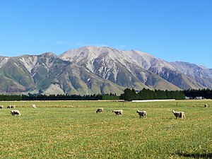
View of the mountain from east on Coleridge Road |
||
| height | 2185 m | |
| location | Canterbury Region , South Island , New Zealand | |
| Mountains | Mount Hutt Range , New Zealand Alps | |
| Coordinates | 43 ° 28 '18 " S , 171 ° 31' 33" O | |
|
|
||
|
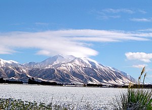
View from the south of the Mount Hutt Range with Mount Hutt in the background |
||
Mount Hutt is a mountain in the New Zealand Alps northwest of the Canterbury Plains in the Canterbury region ofthe South Island of New Zealand .
geography
The mountain is located around 90 km west of Christchurch and is part of the Mount Hutt Range , which extends west of the Rakaia River for around 17 km in a north-south direction. The Mount Hutt has a height of 2,185 m and is bordered north and south by two three thousands summit. About 1.5 km south of the summit is the Mt Hutt ski field , which can be reached via the New Zealand State Highway 77 . To the north of the mountain, the Redcliffe Conservation Area extends over the northern part of the Mount Hutt Range .
Flora and fauna
The lower flanks of the mountain and with it those of the mountain chain of the Mount Hutt Range are forested and mostly overgrown by the New Zealand mountain beeches ( Nothofagus solandri var. Cliffortioides ). As more species of trees can Halls Totara ( Podocarpus laetus ), the Fuchsia excorticata under the, Māori Kōtukutuku is called, the evergreen tree Putaputāweta ( Carpodetus serratus ), the Pittosporum Tenuifolium ( Pittosporum tenuifolium ) of the Māori Kōhūhū called and Pokaka ( Elaeocarpus hookerianus ) can be found. Tussock , bushes and shrubs as well as various herbs grow above the tree line, with the upper mountain flanks showing little vegetation up to the summit region.
The Maori bell honeyeater , gray-coat spectacled birds , Maori flycatchers , green panties , Maori fruit pigeons and Maori ygons are birds that are native to the mountainous regions. Occasionally pieper and keas can also be found.
Panoramic photo
Mount Hutt ski area
The Mt Hutt Skifield is from the south of New Zealand State Highway 77 via a 16.5 km long mountain road, km over 13 on the ridges of the southern part of the Mount Hutt Range up to an altitude of 1,597 m hinaufschlängelt. It is one of the highest roads in the country, was built in 1970 and consists in part of a single unpaved lane that poses a challenge to drivers in bad weather conditions.
The ski area, which is served by three lifts, itself extends on the south to south-west flanks of the South Peak from 1438 m to an altitude of 2086 m , with the base station located at an altitude of 1610 m .
Web links
Individual evidence
- ↑ a b c Topo maps . Land Information New Zealand , accessed December 13, 2018 .
- ↑ Coordinates and longitudes were determined using Goggle Earth Pro Version 7.3.1.4507 on December 13, 2018
- ↑ a b c Mount Hutt area . Department of Conservation , accessed December 13, 2018 .
- ^ Mount Hutt Access Road . dangerousroads.org , accessed December 13, 2018 .
- ↑ Mt Hutt Ski Field . Mt Hutt , accessed December 13, 2018 .


