Mount Whitney
| Mount Whitney | ||
|---|---|---|
|
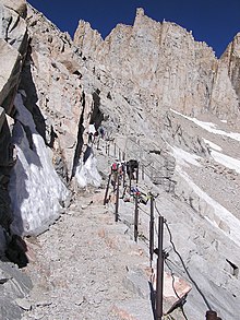
East side of Mount Whitney |
||
| height | 4421 m | |
| location | California , USA | |
| Mountains | Sierra Nevada | |
| Dominance | 2649 km → Nevado de Toluca | |
| Notch height | 3071 m | |
| Coordinates | 36 ° 34 '42 " N , 118 ° 17' 31" W | |
|
|
||
| First ascent | 1873 by Charles Begole, AH Johnson, John Lucas | |
| Normal way | from the Whitney Portal to Outpost Camp | |
| particularities | Highest mountain in California and the United States outside of Alaska | |
The Mount Whitney (in the language of Paiute Tumanguya ) is a 4421 m high mountain in California and the highest mountain in the United States outside of Alaska . Throughout the United States with 6190 m height of Denali ( Mount McKinley ) in Alaska's highest mountain.
history
Origin of the name
The mountain was named after Josiah Whitney (1819-1896), a state geologist from California.
First ascent
The first ascent was made in 1873 by Charles Begole, AH Johnson and John Lucas, who lived as fishermen in Lone Pine .
Location and surroundings
Mount Whitney is located on the eastern edge of the Sierra Nevada in California. Its summit lies on the border between Sequoia National Park and the Inyo National Forest and rises more than 3000 m above the village of Lone Pine (1,130 m) in the Owens Valley . While the landscape drops steeply to the east into the dry, treeless Owens Valley, the Sierra Nevada continues to the west with further high peaks and mountain lakes. Mount Whitney forms a long ridge to the south from which a few rock needles rise, such as the Keeler Needle or Mount Muir .
Routes to the summit
The normal route is the approx. 17.7 km long ascent from the Whitney Portal to 2458 m, which is accessible by motor vehicle. It does not present any significant technical difficulties. Mount Whitney is therefore a popular destination for mountain hikers. The ascent can be done either in one day or as a multi-day tour. The Outpost Camp (3158 m) or the Trail Camp (3669 m) can be used for overnight stays . However, due to the absolute altitude and the difference in altitude, the hike requires perseverance and good altitude adaptation, especially if it is carried out as a day hike.
Another ascent leads over the western flank and meets the normal route near the Scharte Trail Crest . This climb can be reached via the long-distance hiking trails John Muir Trail and High Sierra Trail , each of which ends at the summit of Mount Whitney. There are no technical difficulties to overcome here either.
The approx. 340 km long John Muir Trail has its starting point (on an ascent in north-south direction) in Happy Isles in the Yosemite Valley ; the 98 km long High Sierra Trail begins at the starting point of Crescent Meadow in the Giant Forest , part of the Sequoia National Park.
For climbing Mount Whitney a license ( Engl . Permit ) required by the Forest Service will be issued.
Individual evidence
- ↑ Information on the Pacific Crest and John Muir Trails . Yosemite National Park website - Description of the Pacific Crest and John Muir Trails. Retrieved August 19, 2012.
- ↑ Information about the High Sierra Trail . Sequoia and Kings Canyon National Parks Website - Description of the High Sierra Trail. Retrieved August 19, 2012.


