Muldrow Glacier
| Muldrow Glacier | ||
|---|---|---|
|
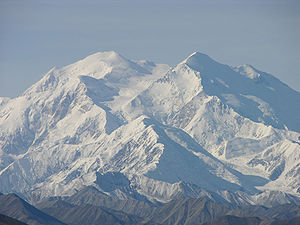
Denali, the Muldrow Glacier in the lower right corner of the picture |
||
| location | Alaska ( USA ) | |
| Mountains | Alaska chain | |
| Type | Valley glacier | |
| length | 50 km | |
| Exposure | North | |
| Altitude range | 3350 m - 900 m | |
| width | ⌀ 2.2 km | |
| Coordinates | 63 ° 12 ′ N , 150 ° 50 ′ W | |
|
|
||
| drainage | McKinley River → Kantishna River | |
The Muldrow Glacier is a 50 km long valley glacier on the northwest flank of the Alaska range in Alaska (USA). The glacier was named after Robert Muldrow II. (1864-1950), American geologist and in 1888 co-founder of the National Geographic Society .
geography
The glacier is entirely within Denali National Park . The nutrient area of the Muldrow Glacier is on the northeast flank of the Denali massif. The Harper Glacier , which flows between the main and north peaks of Denali, forms the source glacier of the Muldrow Glacier. This flows in an east-northeast direction. It takes in the Traleika Glacier and the Brooks Glacier , both from the right. The Muldrow Glacier eventually turns north for the last 15 km. The lower end of the glacier is at an altitude of 900 m . The Muldrow Glacier is drained by the McKinley River and the Kantishna River . The average glacier width is 2.2 km.

