Nabro
| Nabro | ||
|---|---|---|
| height | 2218 m | |
| location | Debubawi Kayih Bahri , Eritrea | |
| Coordinates | 13 ° 22 ′ 0 ″ N , 41 ° 42 ′ 0 ″ E | |
|
|
||
| Type | Stratovolcano | |
| Last eruption | June 13, 2011 | |
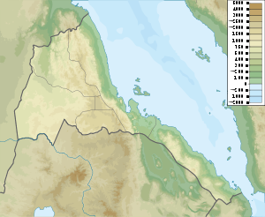
The Nabro is a 2218 meter high stratovolcano in Eritrea on the Red Sea . It is the highest volcano in the geologically active Danakil Desert , which borders Ethiopia and belongs to the Afar Triangle , which in turn is part of the East African Rift .
The Nabro forms a double caldera system in which one caldera has a diameter of five kilometers and the other a diameter of eight kilometers. Rhyolithic lava domes and basaltic lava flows have been discovered in the craters .
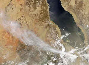
The volcano erupted in mid-June 2011, ending a period of rest of unknown duration.
Volcanic activity
In the course of a series of earthquakes, some of which reached a magnitude of 5.7, an eruption occurred on the morning of June 13, 2011 at around 01:00 CEST, which was first attributed to the nearby Dubbi . Air traffic in East Africa was affected by the ash cloud .
The area in which the Nabro is located is a sparsely populated border area between Ethiopia and Eritrea ; a road near the volcano is considered unsafe. Initially, nothing was known about major consequences of the damage.
Web links
- Nabro in the Global Volcanism Program of the Smithsonian Institution (English)
- TS Bochum: Nabro Terra Storm

