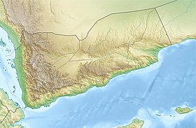
Na'it
Na'it in what is now Yemen |
Na'it ( Arabic ناعط, DMG Nā'iṭ ) is a village and archaeological place from the Old South Arabian - Sabean era, which in Yemen is highland basins.
The village itself has nothing special except for an unusually deep, Himyarian cistern and in mosques as well as in some houses built, ancient inscription stones.
geography
Na'it is located in the ʿAmrān governorate , about 87 kilometers north of Sanaa and just over 20 kilometers northeast of ʿAmrān on the southeast end of the Jabal Thanayn . To get there, nowadays at Raida you turn onto an unpaved slope stretching south-eastwards towards the difficult to explore location.
history
A Himyar-Sabaean war must have occurred around the middle of the 1st century AD. Himyar conquered large parts of the southern Sabaean empire and derived hegemonic claims from it. In return, Saba made claims on Himyar ( Ḏū-Raydān ). The rulers of both kingdoms called themselves King of Saba 'and Ḏū-Raydān from that time . Na'it was under the rule of the Hamdānid kingdom, with that same name, for decades from about 90 AD. The Banū Hamdān clan belonged to the Sum'ay tribal federation , as did the Banū Bataʿ clan in ʿāz and al-Ḥuqqa, which ruled the southwestern neighborhood .
The Yemeni scholar of the 10th century, al-Hamdānī , reports in his work "The Diadem" ( al-Iklīl ), an encyclopedia about ancient southern Arabia , that the ruins of Na'it allowed conclusions to be drawn about the most magnificent buildings in Yemen. The city was also surrounded by a white wall and included more than 22 large castles. A number of epigraphs from the city were dedicated to the Ta'lab (cited as CIH 297, 298 and 300; RES 4994 and the graffiti RES 5000-5003). According to CIH 300, a temple was dedicated to Ta'lab Riyām ba'l (dy) Tar'at . The ruins have hardly been excavated to this day, which is why it is unclear what connections could be made to other temples. It is also possible that inscriptions were simply carried off to Na'it. This assumption is made with regard to an inscription for Ta'lab ḤẒYYHN , a village at the foot of the Jabal Ḍurb, from the village of the same name .
The sparse scientific findings on the field of ruins in Na'it show that it can be assumed that the enclosing wall of the ancient Na'it had a diameter of 400 meters and was elliptical . At the end of the field stood (and stand again) two simple, five-meter-high pillar monoliths with a rectangular cross-section, one leaning against the other (and with a new platform).
see also article section: Architectural history of South Arabia
Individual evidence
- ^ Horst Kopp : Geography of Yemen . Dr. Ludwig Reichert Verlag, Wiesbaden 2005, pp. 30, 37; see also the listing of the place of discovery in the map enclosed there
- ↑ a b c d e Hermann von Wissmann , Collection Eduard Glaser III, On the history and regional studies of Old South Arabia, pages 315 f. and 373
- ↑ Gerd Simper, Petra Brixel: Yemen. Reise-Know-How, Bielefeld 2002, pp. 218–220.
- ↑ Hermann von Wissmann, On the archeology and ancient geography of South Arabia, p. 11
- ↑ Because this family became a royal family of Saba, the name Hamdān expanded greatly. The large tribal groups or federations of the āšid and the Bakīl counted themselves among the Hamdān in Islamic times. But the name Hamdān also remained common for a narrower dormitory district: it had supplanted the name SM'Y (Sum'ay) and was about to replace it . / H. v. Wissmann, p. 297 (footnote 83)
- ^ Hermann von Wissmann, Eduard Glaser III Collection, On the History and Regional Studies of Old South Arabia, Genealogical Table 3
- ↑ An illustration of the monolith pillars placed on a stone pedestal due to severe weathering of the foot area of the pillars can be found in : Simper, Brixel, Yemen , p. 219 (see lit.)
literature
- Horst Kopp (Ed.): Geography of Yemen . Dr. Ludwig Reichert Verlag, Wiesbaden 2005, ISBN 3-89500-500-2
- Gerd Simper, Petra Brixel: Yemen. Reise-Know-How, Bielefeld 2002, ISBN 3-921497-09-4
- Hermann von Wissmann : On the history and regional studies of old South Arabia. ( Eduard Glaser Collection , No. III = Austrian Academy of Sciences, Philosophical-Historical Class, Meeting Reports, Volume 246) , Böhlaus, Vienna 1964.
- Hermann von Wissmann: On the archeology and ancient geography of South Arabia , subtitles: Ḥaḍramaut, Qatabān and the ʿAden area in antiquity , Istanbul / Leiden 1968
Coordinates: 15 ° 46 ′ 50 ″ N , 44 ° 7 ′ 47 ″ E
