Jeannette Kawas National Park
| Jeannette Kawas National Park | ||
|---|---|---|
| Punta Sal | ||
|
|
||
| Location: | Honduras | |
| Surface: | 781.5 km² | |
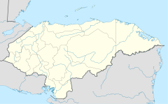
The Jeannette Kawas National Park (Spanish: Parque Nacional Jeannette Kawas) is located in the municipality of Tela , on the northern side of the Caribbean coast in the Honduran Atlántida . The park was founded and managed by the PROLANSATE organization. The name comes from PROLANSATE Pro tection of Lan cetilla, Punta Sal and Te xiguat.
history
The park was originally named Punta Sal National Park, but was later renamed the Jeannette Kawas National Park in honor of the environmental activist and PROLANSATE President Jeanette Kawas. She was murdered on February 6, 1995 for campaigning to keep palm oil plantations out of the sanctuary.
The national park is part of the Ramsar Convention List for Wetlands of International Importance and was established on March 28, 1995.
geography
The park is located at degrees 15º51'N 087º40'W between longitude 87º29 'and 87º52' west and latitude 15º42 'and 16º00' north on the north coast of Honduras. The park is 781.5 square kilometers.
Ecosystem
The park is home to numerous ecosystems with a large number of different species. These ecosystems differ in:
- beaches
- Tropical forests
- flooded forests
- Mangrove forests
- Lagoons
- Rivers
Animals
Birds
Mammals
fishes
Reptiles
- American crocodile
- Sea turtles , such as the green turtle , leatherback , hawksbill and loggerhead turtle
- Green iguana
- Idol snake
- Pointed head python
Arthropod
plants
- Acalypha skutchii
- Cappatis truerchkhemii
- Columnea tuerckheimii
- Cordia truncatifolia
- Ormosia macrocalyx
- Phyllanthus elsiae
- Rinorea hummelii
- Salacia impressifolia
- Sida antillensis
- Sida troyana

