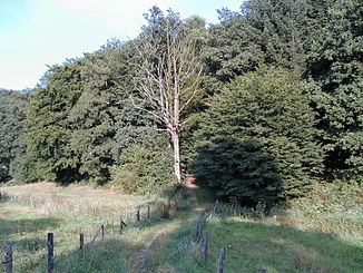
Hengstener Bach
| Hengstener Bach | ||
|
The Hengstener Bachtal |
||
| Data | ||
| Water code | DE : 273639152 | |
| location | Wuppertal | |
| River system | Rhine | |
| Drain over | Wupper → Rhine → North Sea | |
| source | In Spieckern 51 ° 13 ′ 34 ″ N , 7 ° 17 ′ 20 ″ E |
|
| Source height | 303 m above sea level NN | |
| muzzle | At Beyenburg in the Beyenburger reservoir ( Wupper ) Coordinates: 51 ° 14 '40 " N , 7 ° 17' 58" E 51 ° 14 '40 " N , 7 ° 17' 58" E |
|
| Mouth height | 191 m above sea level NN | |
| Height difference | 112 m | |
| Bottom slope | 39 ‰ | |
| length | 2.9 km | |
| Catchment area | approx. 2 km² | |
The Hengstener Bach is a 2.893 kilometer long brook and a tributary of the Wupper , which has its source in Wuppertal - Spieckern . It flows in the Wuppertal district of Langerfeld-Beyenburg .
etymology
The etymological origin of the old place name Hengsten comes from "Henstwerdt" (1547), from which a connection with a stallion can be seen.
topography
The stream rises at around 314 meters above sea level in the hamlet of Spieckern. After around 40 meters, the stream is piped for a distance of around 120 meters from the village in a northerly direction. From here the stream runs along fields.
Along the foot of a wooded hill on the right-hand side, the stream leads past the district of Niedersondern . Around 2050 meters after the source, the Hengstener Bach is directed to the east and runs between Gangolfsberg and Siegelberg . The deeply cut brook valley is wooded.
In the vicinity of a driveway to Hofschaft Hengsten , the brook flows into the Beyenburg reservoir , an impoundment of the Wupper, at around 213 meters above sea level . In the lower reaches of Hengsten, the Elberfeld line of the Bergische Landwehr crosses the stream.
natural reserve
The valley of the Hengstener Bach is under nature protection on an area of around 60 hectares .
See also
Web links
- Nature reserve "Hengstener Bach" (W-008) in the specialist information system of the State Office for Nature, Environment and Consumer Protection in North Rhine-Westphalia
Individual evidence
- ↑ a b German basic map 1: 5000
- ^ Topographical Information Management, Cologne District Government, Department GEObasis NRW
- ↑ Measurement using a topographic map 1: 25,000
- ↑ River Geographic Information System of Wupperverbandes
- ^ Wolfgang Stock: Wuppertal street names . Thales Verlag, Essen-Werden 2002, ISBN 3-88908-481-8
