Nerkin Sasnaschen
|
Nerkin Sasnaschen Ներքին Սասնաշեն |
||
| State : |
|
|
| Province : | Aragazotn | |
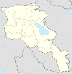
| Coordinates : | 40 ° 21 ′ N , 44 ° 0 ′ E | |
| Height : | 1800 m | |
| Area : | 10.9 km² | |
| Residents : | 904 (2011) | |
| Population density : | 83 inhabitants per km² | |
| Time zone : | UTC + 4 | |
| Postal code : | 0513 | |
| Mayor : | Andranik Schamojan | |
|
|
||
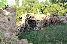
Nerkin Sasnaschen ( Armenian Ներքին Սասնաշեն ; formerly Nerkin Karakojmas and Nerkin Sassunaschen ) is a village in the Aragazotn Province in Armenia . Here are the ruins of an Armenian monastery from the 7th century. After a US Hercules was shot down in 1958 , the machine hit here.
geography
Nerkin Sasnashen is 14 km from the district town of Talin , 40 km from the district town of Ashtarak and 65 km from the capital Yerevan .
There is a moderate mountain climate. The winters are severe, with cold, stable snow cover. Summers are hot and relatively humid. The average temperature in July fluctuates between 16 and 18 ° C and in January between −6 and −8 ° C. The annual rainfall is 450 to 600 mm.
The village has 326 households. There is a secondary school named after the Armenian artist and scientist Henrik Howhannisjan , a library, a kindergarten, a health station and a community center.
There is no industry. Most of the residents work in an agricultural cooperative. The agriculturally used areas are mainly used as pastures (80%), arable land and grassland. Vegetables, cereals and forage crops are grown. Most of the agricultural crops are used for breeding livestock. Cattle and poultry are raised.
The church is poor. In 2017, 80% of the municipal budget came from state financial equalization.
history
In the village there are the ruins of an Armenian monastery from the 7th century.
During the Armenian genocide between 1915 and 1918, native Azerbaijanis and Jews were expelled and Armenians displaced from the areas of the now Turkish cities of Sason , Mus and Hınıs were resettled. A second church was built at the beginning of the 20th century. In 1946 the village was given its current name.
After a Hercules of the US Air Force was shot down by a Soviet MiG-17 , the plane crashed in the village on September 2, 1958. All 17 crew members died. There is a memorial obelisk in the village for this event.
Population development
| year | 1831 | 1873 | 1897 | 1922 | 1926 | 1931 | 1939 | 1959 | 1970 | 1979 | 1989 | 2001 | 2004 | 2011 |
|---|---|---|---|---|---|---|---|---|---|---|---|---|---|---|
| population | 49 | 265 | 233 | 345 | 362 | 452 | 668 | 750 | 901 | 877 | 1032 | 999 | 1093 | 904 |
| source |
Web links
- Brady Kiesling: Rediscovering Armenia. An Archaeological / Touristic Gazetteer and Map Set for the Historical Monuments of Armenia . Yerevan / Washington DC June 2000 (English, archive.org [PDF; 1.9 MB ]).
- NERKIN SASNASHEN MUNICIPALITY. In: spyur.am. Retrieved May 8, 2018 .
- Ն. Սասնաշեն - Համայնքի մասին - Համայնքներ - Արագածոտնի մարզպետարան. In: aragatsotn.mtad.am. Retrieved May 8, 2018 (Armenian).
Individual evidence
- ↑ Ն. Սասնաշեն - Համայնքի մասին. In: aragatsotn.mtad.am. Արագածոտնի մարզպետարան, Retrieved May 8, 2018 (Armenian).
- ↑ ՀՀ Արագածոտնի մարզի Ներքին Սասնաշեն համայնքի 2016 թ-ի բյուջեի կատարման տարեկան հաշվետվություն. In: azdarar.am. Հայաստանի Հանրապետության ինտերնետով ծանուցման պաշտոնական կայք, Retrieved May 8, 2018 (Armenian).
- ^ David Underwood: Armenian Food: A Day of Oghormi at Nerkin Sasnashen - Honoring the Dead. In: armenianfood.blogspot.de. June 26, 2006, accessed May 8, 2018 .
- ↑ RA Aragatsotn MARCH. Marzes of the Republic of Armenia in Figures, 2008. (PDF) In: armstat.am. Accessed May 7, 2018 .
- ↑ Nerkin Sasnashen (Talin, Aragatsotn, Armenia) - Population Statistics, Charts, Map, Location, Weather and Web Information. In: citypopulation.de. Retrieved May 8, 2018 .

