Netzberg (Harz)
| Netzberg | ||
|---|---|---|
|
View over the Beretal to the Netzberg (right) |
||
| height | 486.5 m | |
| location | north of Ilfeld , Nordhausen district , Thuringia | |
| Mountains | resin | |
| Coordinates | 51 ° 35 '56 " N , 10 ° 46' 49" E | |
|
|
||
The Netzberg is a 486.5 m high mountain north of Ilfeld in the Harz Mountains .
description
The striking Kegelberg rises west of the Bere valley and is bordered to the north by the Schuppenbach valley and south by the Fischbachtal valley. The Ilfeld valley brewery is located southeast of the mountain and Netzkater is northeast . The 505 m high Dühringsklippe lies about 460 meters to the south-east .
The Netzberg is mentioned in documents as Netzwigessberg as early as 1263 . It was named after a fish pond in today's Beretal, which was created by the monks of the Ilfeld Monastery at the beginning of the 13th century. In 1271 the Netzberg ( Neczewagesberch ) was sold by the Counts of Hohnstein to the Ilfeld Monastery .
In the middle of the 13th century, the hermit Jordanis lived in the lonely forest on Netzberg .
Friedrich Gottschalck reported in 1806: Under the Netzberge north-west of Ilfeld there is a purifying spring on the Ochsenplatze and a type of Kattunstein that breaks into slate.
In 1845 Pastor H. Müller reports: “In the charming Behrthale, the so-called goose beak , which is a beautiful rocky area, is worth seeing. Furthermore lies the Netzberg, a cone-like shape where you can find red jasper . At the foot of it is a spring, the water of which carries the purge . "
The Netzberg has been known since ancient times as the place where chalcedony almonds were found .
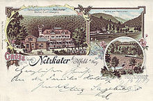
At the eastern foot of the mountain leads the federal road 4 , which leads down through the Schuppental (valley of the Schuppenbach) from Rothesütte and into which the federal road 81 coming from Hasselfelde joins the former Hotel Netzkater . A Hanoverian Chausseehaus was built here after 1848, where tolls for road use had to be paid, as Ilfeld was then part of the Kingdom of Hanover . Opposite the former Chausseehaus (which later became the "Netzkater" hotel) there is now a rest stop and biker meeting point.
Below the Netzberg lies the Netzwiese through which the Bere flows and at the end of which the Bundesstraße 4 leads over the Bere on the Netzberg bridge.
Individual evidence
- ↑ a b Saxony-Anhalt-Viewer: official topographical map of Saxony-Anhalt (TK 1:10 000 color)
- ↑ official topographical map of Thuringia, DTK25-V combination in color
- ↑ Karl Meyer: Die Burg Hohnstein [...], 1897, p. 13.
- ↑ Ilfeld Regesten No. 66
- ↑ Friedrich Gottschalck: Pocket book for travelers in the Harz , Magdeburg 1806, p. 252
- ↑ H. Müller: Oddities [...] about the Upper and Lower Harz , Leipzig undated, pp. 361–362
- ^ New Yearbook for Mineralogy, Geology and Paleontology , 1858, p. 170


