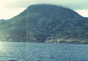
Nila (volcano)
| Nila | ||
|---|---|---|
|
Nila Volcano (1976) |
||
| height | 781 m | |
| location | Nila , Indonesia | |
| Coordinates | 6 ° 44 '15 " S , 129 ° 30' 39" E | |
|
|
||
| Type | Stratovolcano | |
| Last eruption | 1968 | |
| particularities | Highest mountain in Nile | |
The Nila is a stratovolcano on the Indonesian island of Nila , which belongs to the Barat Daya Islands in the Banda Sea . At 781 m, it is the highest mountain on the island.
In 1932 a heavy ash rain erupted from a crevice in the southeast - as a result, the village of Rumadai on the east coast of the island had to be abandoned.
On May 7, 1968, there was a phreatic explosion on the eastern flank . Further outbreaks took place in 1903 and 1964. In the north and west of the island there are openings on the sea floor at a depth of 20 to 30 m, from which gas bubbles rise.
The Nila is one of the numerous volcanoes of the Banda Arch - the closest is 50 km southwest of the Serawerna on the island of Teun .
Web links
- Nila (Vulkan) in the Global Volcanism Program of the Smithsonian Institution (English)

