Barat Daya Islands
| Barat Daya Islands | ||
|---|---|---|
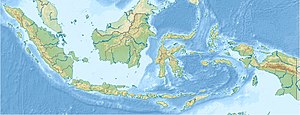
| Map of the Barat Daya Islands | ||
| Waters | Banda Lake | |
| archipelago | Lesser Sunda Islands | |
| Geographical location | 7 ° 48 ′ S , 126 ° 18 ′ E | |
|
|
||
| Main island | Wetar | |
| Total land area | 4000 km² | |
The Indonesian Barat Daya Islands ( German southwest (er) islands ) are located in the Banda Sea and form the extension of the Inner Banda Arch to the east.
geography
Geographically, the islands form the northeastern end of the Lesser Sunda Islands - Atauro is 10 km northeast of Liran . To the west of the Strait of Ombai is the island of Alor , to the south, across the Strait of Wetar, is the island of Timor .
The westernmost island is Liran (Lirang). It is located off the southwest tip of Wetar , the largest island in the group. Immediately off the northwest coast of Wetar is the small island of Reong . To the east of Wetar follow Romang (Roma) with the small islands Njata , Mitan , Tellang , Limtutu , Laut , Kital , Maopora and Djuha and the Damar Islands with Damar (Damer), the atoll Nus Leur , Terbang Utara , Terbang Selatan and Teun , before the chain of islands makes an arc to the northeast with the islands of Nila with Nika , Nil Desperandum , Serua with Kekeh-Besar and Manuk .
Politically, the archipelago, like the islands to the southeast of it, belongs to the administrative district ( Kabupaten ) of southwestern Moluccas ( Maluku province ).
history
From the 17th century the Dutch East India Company established military bases on Romang, Damar, Nila and Wetar.
See also
Individual evidence
- ^ Ernst Christoph Barchewitz . East Indian travel description. His Eilff-year stay on Java, Banda and the southwestern islands, cases of luck and misfortune and strange occurrences ..., Chemnitz 1730, Liber II What the author discovered in India, Cap. X-XXXII, pp. 206-512

