Tidors
| Tidors | ||
|---|---|---|
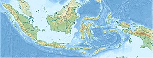
| Location of Tidore | ||
| Waters | Moluccan Sea | |
| Archipelago | Moluccas | |
| Geographical location | 0 ° 41 ′ N , 127 ° 24 ′ E | |
|
|
||
| surface | 116 km² | |
| Highest elevation |
Keimatubu 1730 m |
|
| main place | Soasio | |
| Tidore seen from the speedboat dock on Ternate. On the right in the background the Gunung Api Keimatubu | ||
Tidore is an Indonesian island of the Moluccas in the province of the Northern Moluccas ( Maluku Utara ). It lies together with the island of Ternate west of Halmahera in the Moluccan Sea and is dominated by the 1730 m high Keimatubu volcano.
geography

In the southeast of the island of Ternate, the 116 square kilometer island of Tidore is located across a two kilometer wide strait. Speedboats run regularly between the towns of Bastiong on Ternate and Rum in the north-west of Tidore. Most of the residents live along the coastal road that leads from here to the market town of Soa Siu in the southeast. A road continues up the eastern slope of Keimatubu to Gurabunga. Bananas and taro thrive on the lower mountain slopes , a little above is a light forest belt in which cloves and nutmeg trees are planted. The tree line is reached about 100 meters below the summit. The crater of the typical stratovolcano , which last erupted in 1969, is around 70 meters in diameter. In the north is sparsely populated hill country with a flat caldera and two smaller volcanoes.
The island of Tidore belongs administratively to the city ( Kota ) Tidore Islands ( Tidore Kepulauan ), which is directly subordinate to the province of the Northern Moluccas and to which part of the west coast of Halmahera also belongs. The seat of government is Soasio .
The island of Tidore is divided into four districts ( Kecamatan ). In the northwest lies the north tidore ( Tidore Utara ) with the offshore island of Maitara . The northeast is formed by the East Tidore ( Tidore Timur ). In the southeast is the Tidore district with the seat of government for the Soasio administrative district. The island of Mare also belongs to the south tidore ( Tidore Selatan ) in the south .
history
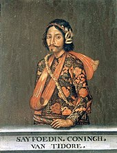
Tidore found his wealth in the spices clove and nutmeg that grow on the island . The island developed into an important sultanate in the 16th century . At times the sultans there also ruled over the islands of Halmahera, Buru , Ambon and western New Guinea . Tidore's constant rival was the Sultanate of Ternate . The first Europeans to land on Tidore were the Portuguese in 1511 , who found the island to be one of the endpoints of the spice route they had developed. In the course of the first circumnavigation of the world, Juan Sebastián Elcano , the successor of Ferdinand Magellan, who had just been killed, reached the island in 1522 . He negotiated with the local sultan about deliveries of spices. In 1599 the Dutch East India Company arrived in the region. However, the Sultanate of Tidore allied itself with the Spaniards who were also active in the Moluccas and was able to maintain its independence for a long time, only becoming a Dutch vassal in 1779. During the fourth Anglo-Dutch War from 1780 to 1784 , the sultanate tried to gain independence with the help of the British. This attempt failed, however, and so the ringleader Prince Qadi Abdussalam was deported to the Cape Colony as a prisoner of state on Robben Island . Apart from a brief British occupation during the Napoleonic Wars , Tidore remained in Dutch hands until World War II . The occupation by the Japanese in this war was followed by the incorporation into the new state of Indonesia.
Web links
Individual evidence
- ↑ a b Map of the city of Tidore , accessed on July 23, 2013
- ^ Administrative map of Tidore Island , accessed July 23, 2013
- ↑ Physical map of the Northern Moluccas , accessed on July 23, 2013
- ↑ Robben Island sahistory.org.za/archive/1700-1799 (English) , taken on July 16, 2016


