Ambelau
| Ambelau | ||
|---|---|---|
| Map of Ambelau | ||
| Waters | Banda Lake | |
| Archipelago | Great Sunda Islands , Moluccas | |
| Geographical location | 3 ° 52 ′ S , 127 ° 12 ′ E | |
|
|
||
| surface | 306 km² | |
| Highest elevation | Baula 608 m |
|
| Residents | 9600 (2009) 31 inhabitants / km² |
|
| main place | Wailua | |
Ambelau or Ambalau is a volcanic island in the Indonesian archipelago of the Moluccas southeast of Buru .
geography
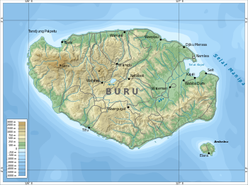
Ambelau is located in the Banda Sea at the entrance to the Manipa Strait about 20 km southeast of the larger island of Buru . It is slightly oval in shape with a bulge in the southeastern part and a maximum diameter of about 10 km.
The island forms a district ( Indonesian Kecamatan Ambalau ), which belongs to the administrative district South Buru ( Indonesian Kabupaten Buru Selatan ) within the province of Maluku ( Indonesian Provinsi Maluku ). The administrative center is Wailua , a settlement in the south of the island.
Ambelau is of volcanic origin and lies in a seismically active zone with frequent earthquakes. The last major earthquake occurred in August 2006. The island rises steeply from the sea and is mostly mountainous. The highest points are the Baula at 608 m and the Nona at 559 m in the west. There are only plains on the south and east coasts. Ambelau is made up of Cenozoic sedimentary rocks.
The flora and fauna of the island are diverse and similar to that of Buru. There are a number of coral reefs off the coast of Ambelau . Large areas, especially in the mountains, are covered with tropical rainforest .
Residents
About half of the population are indigenous Ambelau who speak the language of the same name; the other half are immigrants from the Moluccas and Java .
Individual evidence
- ↑ Pemekaran BURSEL ( Memento from April 9, 2008 in the Internet Archive )
- ↑ Penduduk Indonesia menurut desa 2010 ( Memento from March 27, 2014 in the Internet Archive ) (Indonesian; PDF; 6.0 MB), accessed on January 26, 2013
- ↑ a b c Prostar Sailing Directions 2004 New Guinea Enroute , ISBN 1577855698 , p. 46
- ↑ Tremor jolts Banda Sea ( Memento of 21 March 2012 at the Internet Archive )
- ↑ a b page no longer available , search in web archives:


