
Ternate
| Ternate | ||
|---|---|---|
 |
||
| Waters | Moluccan Sea | |
| Archipelago | Moluccas | |
| Geographical location | 0 ° 48 ′ N , 127 ° 20 ′ E | |
|
||
| surface | 112.3 km² | |
| Highest elevation |
Gamalama 1715 m |
|
| Residents | 176,000 (2010) | |
| main place | Ternate | |
 |
||

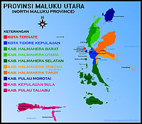
Ternate is an Indonesian island of the Moluccas in the Northern Moluccas Province ( Maluku Utara ).
geography
Together with other volcanic islands, it lies off the west coast of Halmahera Island and extends from about 0 ° 45 'to 0 ° 52' north latitude and from 127 ° 17 'to 127 ° 23' east longitude. The island measures about 11 kilometers from west to east and about 13 kilometers from north to south; their area is 112.3 km².
Ternate consists of the uppermost area of the Gamalama volcano , which rises around 4,300 meters from the sea floor and rises 1715 m from the sea as an active stratovolcano and last erupted in October 2018. The basaltic and andesitic igneous rocks of this volcano have weathered to form fertile soils on the coasts. With the exception of a larger gap in front of the northwest coast and two gaps in front of the northeast and south coast, Ternate is surrounded by coral reefs all around.
Residents
The island had around 176,000 inhabitants in 2010. Around 161,300 people live in the capital Ternate , which is in the southeast of the island, and in its outskirts, which extend over 10 kilometers from Babullah Airport in the north to Bastiong on the south coast.
The language spoken on Ternate is closely related to those on Tidore and Northeast Halmahera and is one of the Papuan languages . It served as a lingua franca in the sphere of influence of the former sultanate . In the capital area, on the other hand, Malay Ternate, a separate dialect of Malay , is common.
history

The north alignment is rotated 90 ° horizontally to the right. At the bottom of the map, “Gilolo I” shows the west coast of Halmahera Island .

,_Indonesia_(2010).jpg)
In addition to the island of Ternate, the Sultanate of Ternate ruled half of the island of Moti south of Tidore . The north of Halmahera (the empire in the northwest of Jailolo was annexed by Ternate with the help of Portugal), the island of Ambon , the east of Ceram and the northeast of Sulawesi covered an area of about 46,000 km².
The Portuguese Francisco Serrão was the first European to visit Ternate. In 1513 a Portuguese trading post was established. Later, it was sailors who came over briefly from the nearby island of Tidore on November 6, 1521 during the first circumnavigation of the world by Ferdinand Magellan . Ternate was Portugal's main ally in the region. In 1522 the Sultan allowed the construction of a Portuguese fort on Ternate and enabled the Portuguese to trade in his empire, which is why some sources incorrectly list the entire empire as Portuguese property. The situation is similar with Tidore, Ternates' major competitor, who had allied themselves with Spain. In addition to its own island, Tidore ruled over the greater part of Halmahera, the other part of Moti, the island of Makian and parts of western New Guinea. These areas are often listed as Spanish, although there was only one alliance between Tidore and Spain in 1527–1534 and 1544–1545.
In the Treaty of Saragossa , Spain renounced activities on the Moluccas in favor of Portugal in 1529, but Spain tried again and again to gain control of the region until 1545 when the army of Villalobo was defeated by the Portuguese. But Portugal could only benefit from the victory for a short time. The fort on Ternate had to be abandoned in 1575 when the Sultan rebelled against his former allies. They withdrew to Ambon. During the personal union of Spain and Portugal, Spain sent several military expeditions from 1583 to regain control of the region, but the last attack on Ternate in 1602 was unsuccessful.
In 1605 the Spanish fort on Tidore was conquered by the Dutch, while in 1606 the Spanish conquered Ternate and deported the Sultan and his family to Manila . Ternate therefore became an ally of the Dutch. In 1607 the Dutch East India Company built Fort Oranje , but the Spaniards were able to stay on Ternate until 1663. Among the Dutch, Ternate and Tidore developed into centers of cultivation of cloves , which thrive particularly well on slopes near the sea, such as those in Ternate. At times the East Indian company tried to enforce a world-wide monopoly for the cultivation of cloves on Ternate and Tidore .
On Ternate, the naturalist Alfred Russel Wallace wrote his Ternate manuscript , in which he hypothesized “that there is a general principle of nature that causes many varieties to outlive their parent species, and that results in successive variations spreading on and on remove from original type ". On March 9, 1858, Wallace sent his manuscript to Charles Darwin , who then published his work on "The Origin of Species". Both men are now considered the fathers of the theory of evolution . The banded bird of paradise ( Semioptera wallacii ) found on Ternate is named after Wallace.
Ternate remained part of the Dutch colonial empire until World War II . After Indonesia's independence , it first became part of the Maluku Province and has been part of the Northern Moluccas Province since its division in 1999. Together with a few other smaller islands, Ternate forms the city (Kota) Ternate, which is administratively directly subordinate to the province.
Web links
- Ternate: The Residency and its Sultanate / Bijdragen tot de kennis der Residentie Ternate (FSA de Clercq - 1890)
- History of the Sultanate of Ternate
Individual evidence
- ↑ Hasil Sensus Penduduk 2010. Kota Ternate. Data aggregate per Kecamatan. (Indonesian, pdf, 2.8 MB, accessed February 13, 2013).
- ^ On the Tendency of Varieties to Depart Indefinitely From the Original Type . In: Journal of the Proceedings of the Linnean Society: Zoology . Volume 3, No. 9, p. 54, London 1858; on-line
- ^ Atlas Obscura: Ternate Island , accessed April 30, 2019.
- ↑ Map of the Northern Moluccas