Nila (island)
| Nila | ||
|---|---|---|
| Southwest Moluccas with Nila in the northeast | ||
| Waters | Banda Lake | |
| Archipelago | Barat Daya Islands | |
| Geographical location | 6 ° 44 '15 " S , 129 ° 30' 39" E | |
|
|
||
| length | 5 km | |
| width | 6 km | |
| surface | 20.54 km² | |
| Highest elevation | 781 m | |
| Residents | 617 (2010) 30 inhabitants / km² |
|
| main place | Bumey | |
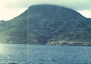
| The Nila volcano on the island of the same name | ||
Nila ( Indonesian Pulau Nila ) is one of the Indonesian Barat Daya Islands in the Banda Sea .
geography
Nila is east of the Damar Islands . It has an area of 20.54 km². Together with their southwestern neighbor Teun and the northeastern Serua , the three islands with a few small islets form the district ( Kecamatan ) Teun Nila Serua . This belongs to the administrative district ( Kabupaten ) of the Central Moluccas (Maluku Tengah), Maluku Province . Nila, Teun and Serua belong to the inner Bandabogen , a chain of islands of volcanic origin.
The small island of Nika is located off the north coast of Nile , as well as the Doesborgh Reef (without islands) a good eight kilometers northwest . Between Serua and Nila is the small island of Nile Desperandum . Ernst Christoph Barchewitz reported that there were hot springs on this island, in which the islanders cooked their meals . On Nila lies the active stratovolcano Nila with a height of 781 m , from which sulfur flowed. It broke out in 1932, so that the village of Rumadai on the east coast had to be abandoned. An eruption occurred on May 7, 1968 on the eastern flank.
history
In the 17th century, the Dutch East India Company established a military base on Nila, which was under the governor of Banda. This consisted of a corporal and two soldiers. In the 18th century, an orang kaya ruled the island of Nila.
population
The villages of Bumey ( Bumei , Bumai ) and Saploru are located on a bay on the south coast . The Austronesian language Teun is spoken in Bumey , the original language of the island of Teun. The Teun language belongs to the Teun-Nila-Serua ( TNS ) language group , as does the other dialect used, Nila .
Bumey is a Desa with 617 residents.
Web links
Individual evidence
- ^ PNAS Islands Database
- ↑ a b Penduduk Indonesia menurut desa 2010 ( Memento from March 27, 2014 in the Internet Archive ) (Indonesian; PDF; 6.0 MB), accessed on January 26, 2013
- ↑ a b c Map of Pulau Nila
- ↑ Gunung Bagging
- ^ Ernst Christoph Barchewitz : East Indian travel description , Chemnitz 1730, p. 500
- ↑ Volcano Discovery: Nila
- ^ Ernst Christoph Barchewitz : East Indian Travel Description , Chemnitz 1730, pp. 500–501
- ↑ Mark Janse, Sijmen Tol: Language Death and Language Maintenance: Theoretical, Practical, and Descriptive Approaches , 2003, pp. 49 ff.


