
Terbang Selatan
| Terbang Selatan | ||
|---|---|---|
 |
||
| Waters | Banda Lake | |
| Archipelago | Damar Islands | |
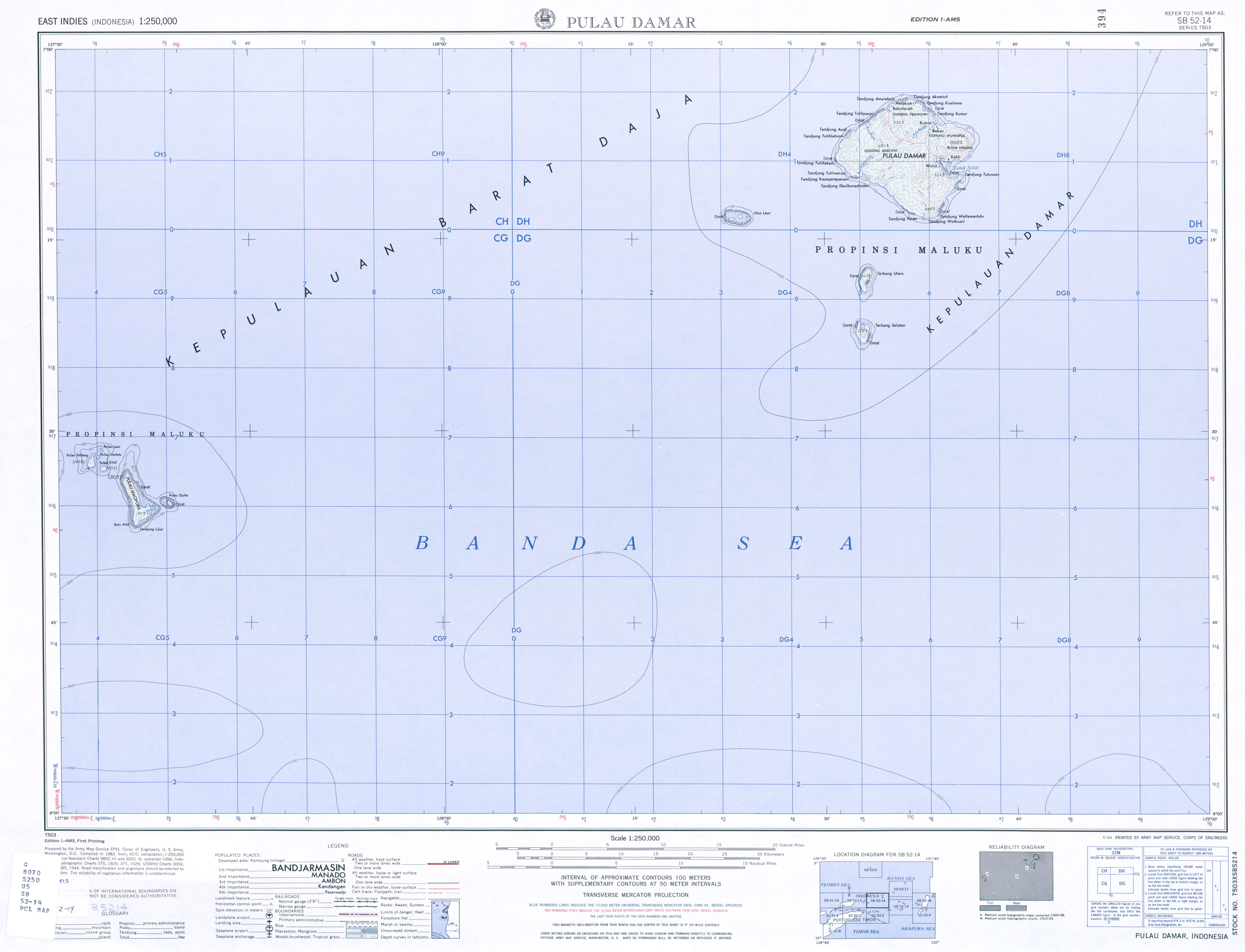
| Geographical location | 7 ° 22 '13 " S , 128 ° 33' 24" E | |
|
||
| length | 3.2 km | |
| width | 2.1 km | |
| surface | 4.78 km² | |
| Residents | uninhabited | |

Terbang Selatan ( South Terbang ) is one of the Indonesian Damar Islands in the Banda Sea and is uninhabited.
geography
Terbang Selatan has an area of 4.78 km² and reaches a height of 122 meters. It is located south of the main island Damar and its sister island Terbang Utara ( North Terbang ). The Damar Islands are part of the Barat Daya Islands and thus the inner Banda Arch , a chain of islands of volcanic origin. The Damar Islands form the sub-district ( Kecamatan ) Damar , which belongs to the administrative district ( Kabupaten ) of the southwestern Moluccas ( Maluku Province ).
For years, the residents of the neighboring towns of Wulur and Kehli on the main island of Damar were in dispute over the rights of use for the uninhabited islands of Terbang Utara and Terbang Selatan and the surrounding waters. In 1986 a court ruled that this bulge was due.
fauna
In 2006, 28 different bird species were recorded on Terbang Selatan.
Individual evidence
- ^ PNAS Islands Database
- ↑ Map sheet 1: 250,000
- ↑ Map of the Southwest Moluccas ( Memento of the original from November 22, 2011 in the Internet Archive ) Info: The archive link was inserted automatically and has not yet been checked. Please check the original and archive link according to the instructions and then remove this notice.
- ↑ Dedi Supriadi Adhuri: Selling the Sea, Fishing for Power, 7th Marine Tenure and the Politics of Legality: Cyanide Fishing
- ↑ Colin R. Trainor: Birds of Damar Island, Banda Sea, Indonesia , November 22, 2006