
Atauro
| Administrative Office Atauro | |

|
|
| Administrative headquarters | Vila Maumeta (Atauro) |
| surface | 140.13 km² |
| population | 9,274 (2015) |
| Sucos | Population (2015) |
| Beloi | 1,678 |
| Biqueli | 2,076 |
| Macadade | 1,632 |
| Maquili | 2,062 |
| Vila Maumeta | 1,826 |
| Overview map | |

|
|

|
|
Atauro (Port. Ataúro , Indon. Pulau Kambing ) is an East Timorese island in the Banda Sea north of Timor . The administrative seat is Vila Maumeta .
The island name means " goat " in the local language , Kambing is the Indonesian word for it. The name comes from the goats that are kept here.
geography

Overview
Atauro is about 22 km long, up to 9 km wide and has an area of 140.13 km². It is west of the Wetar Strait , about 23.5 km off the coast of the state capital, Dili . To the northeast of Atauro are the Indonesian islands of Liran (13 km) and Wetar (21.5 km) and to the west of Alor , across the Strait of Ombai . Atauro is the easternmost of the Lesser Sunda Islands and belongs to the inner Banda Arch , the islands of which are mostly of volcanic origin. So does Atauro, which was formed 3 to 3.5 million years ago. Timor, on the other hand, belongs to the older outer ribbon arch , whose islands were created by the folding of the sea floor. Geologically, the island consists mainly of volcanic material of marine origin, but limestone that has been lifted to the surface of the sea can also be found at an altitude of 600 m . Today the island is no longer volcanically active.
Atauro is rugged and rough. The formerly submarine volcanoes are exposed to erosion. The highest point on the island is the Mano Côco ( Foho Manococo ) with 999 m . Further elevations are the Foho Tutonairana ( 845 m ) and the approximately 800 m high double summit of the conically shaped Foho Berau . The latter two are the former Atauros eruption center . The volcanic rock is 3.1 to 3.5 million years old. Cliffs up to 300 m high, which extend north from the southeast corner of Atauros, and sheltered bays with sandy beaches characterize the coast. A wide reef from 30 to 150 m frames the island. The strait between Atauro and Timor is up to 3500 m deep.
All year round there are no rivers or other bodies of water on the island. The only source of fresh water is located north of Berau . Other waters dry out between May and October, outside of the rainy season.
Administrative division
The island of Atauro forms an administrative office ( Portuguese Posto Administrativo ) of the municipality of Dili . Until 2014, the administrative offices were still referred to as sub-districts . The administrative office is divided into five sucos . Beloi forms the central part of the island, Biqueli ( Bikeli , Biquele , Biceli , formerly Pala ) is on the northern tip of Atauros, Macadade ( Anartuto ) in the southwest, Maquili ( Makili ) on the south east coast and Vila Maumeta ( Atauro Vila ) on the south east coast .
places

The largest place is Vila , the second largest macadade. They are in the south of the island. A possible alternative name for Vila Maumeta is Toro . The villages of Berau, Nameta and Macelihu are on the south coast and Adara , Maquer and Vatuo are on the northwest coast . On the north east coast are the villages of Akrema (Acrema), Beloi, Biqueli and Uaro-Ana . In the interior of the north are the Arlo and Douro .
climate
Atauro has a dry and a rainy season. In the rainy season between November and March, landslides and floods threaten the island. With increasing sea level, the annual amount of precipitation also increases. It is between 700 and 1600 mm per year. The average annual temperature is 24 ° C on the mountains in the south, 26 ° C inland in the north and around 27 ° C on the coast. In the dry season, the temperature on the coast is consistently above 30 ° C and there is no precipitation. In the higher regions, the temperature is 10–20 ° C lower and there is light rain or fog almost every day.
- Climate data

Annual rainfall (2000)

Average annual temperature (2000)


Flora and fauna

The mammalian fauna is still being scientifically studied. So far, an unspecified musang species , a shrew , a small flying fox and two different bat species are known.
Atauro is an Important Bird Area and part of the Timor and Wetar Endemic Bird Area . In 2004 84 bird species were recorded here. 13 more were added in 2007.
So far, amphibians have not been detected on Atauro. Documented lizard species are two forms of the arch-finger gecko ( Cyrtodactylus sp.) , The four- clawed gecko (Gehyra mutilata) , the tokeh (Gekko gecko) , the Asian domestic gecko (Hemidactylus frenatus) , the Leschault's snake-eye skink (Cryptoblepharus) , a previously unspecified leschault (Cryptoblepharus) Skinkart (Eremiascincus) , the multi-striped skink (Eutropis cf. multifasciata) and the emerald skink (Lamprolepis cf. smaragdina) . It is not yet certain whether the monitor monitors that were found belong to the banded monitor monitors (Varanus salvator) . Snake species on Atauro are the Indonesian climbing snake ( Coelognathus subradiatus ), hooded wolf tooth snake ( Lycodon capucinus ), island or wetar pit viper ( Trimeresurus insularis ) and a previously unassigned type of blind snake . Sightings of the adder flattail ( Laticauda colubrina ) and the Timor bronze snake ( Dendrelaphis inornatus timorensis ) have not been confirmed.
In addition to the fields, there is mainly grassland with eucalyptus trees ( Eucalyptus alba ) and some remnants of dry and evergreen, tropical forests, especially on the mountains and in ravines. The forest has been severely cut down since the 16th century. The trees in the lush and humid tropical mountain forest at Mano Côco reach heights of 15 to 20 m. 40 km² around the mountain is a nature reserve.
Atauro is located in the so-called Coral Triangle , the marine waters of which are characterized by high biodiversity . According to a 2016 publication, Atauros reefs are the most biodiverse in the world. On average, 253 different animal species were found at ten sites, 314 at the most species-rich site (the previous record holder in West Papua had 216). A total of 643 species of marine life were counted off the coast of Ataurus. Of the over 300 species of fish in some places, many have not yet been scientifically described. In 2017, for example, the small sea fish Helcogramma atauroensis , which is named after the island, was described for the first time .
Residents

9274 inhabitants live on the island (2015), of which 4669 are men and 4605 women. The population density is 66.2 inhabitants / km². The predominantly Protestant inhabitants of northern Atauros are unusual for the mostly Catholic East Timor . They were evangelized from Alor by Dutch Calvinists in the 20th century. The Catholic faith was not brought to Atauro until the 1950s. There are also Protestants in the south of the island.
Most of Atauro's residents speak Wetar , which is usually spoken on Wetar Island . The language recognized as the national language is also called Atauru . Three Wetard dialects are spoken in Atauro: Rahesuk in the north, Resuk in the southeast and Raklungu in the southwest. A fourth dialect of Wetar, Dadu'a , is spoken mainly by the descendants of a group of Ataurus people who emigrated to villages in the Manatuto municipality of Timor. in Vila Maumeta there is a minority of Dadu'a speakers.
The average age on Atauro is 19.5 years (2010, 2004: 19.0 years).
history


Rock carvings in a cave near Atecru have been dated to an age of around 8,000 years, and archaeologists under the direction of the French Jean-Christophe Galipaud estimated the traces of settlement there to be 18,000 years old. In Arlo , the researchers found traces of villages that were inhabited between 2,500 and 3,000 years ago. The rock paintings show crocodiles and marine mammals , among other things . One picture shows the hunt for a whale. No such motifs in rock paintings are known from East Timor.
The Dutch left the island of Atauro to Portugal in the Treaty of Lisbon in 1859 , but it was not until 1884 that the Portuguese flag was raised in a ceremony on the small island and it was not until 1905 that the inhabitants paid taxes to Portugal. A military post was established in April of the same year.
The parched island was already used by the Portuguese to banish political prisoners from Portugal, Timor and other colonies. A prominent prisoner who presumably also died here was Boaventura , the Liurai of Manufahi and leader of the great rebellion of 1911/1912 . Another exile was Manuel Viegas Carrascalão , the father of the East Timorese politician Manuel Carrascalão (who was born here in 1933). After the Second World War, Japanese collaborators were sentenced to life imprisonment in Atauro, for example Joaquim da Costa Guterres from Ossu , who died here in 1946. Some prisoners remained on the island until 1974. By 1959, Lisbon had sent more than 3,000 people to Atauro as punishment.
As part of the preparations for the independence of East Timor, the UDT attempted a coup on August 11, 1975 to counter the growing popularity of FRETILIN . The last Portuguese governor, Mário Lemos Pires , fled to Atauro, from where he tried to mediate between the two parties. The FRETILIN tried to persuade him to return to Dili and to continue the decolonization, but Pires waited for instructions from the government in Lisbon , which, however, had little interest in East Timor due to the problems in Africa. The chaos favored the later invasion by Indonesia . Atauro was occupied by the Indonesian armed forces on December 30, 1975 , 23 days after the state capital Dili. Shortly afterwards, the Portuguese flag was also lowered in an official ceremony. She stayed behind after Pires and the Portuguese soldiers and their civilians were picked up on December 8 by the Portuguese corvettes João Roby and Afonso Cerqueira . The flag was the last official symbol of Portuguese sovereignty in its Timor colony .
Between 1980 and 1986, Indonesia also used Atauro as a prison island and resettlement camp. At its peak in 1982, there were over 4,000 prisoners here. After the Marabia attack, Indonesia sent the first group of prisoners to Atauro in July 1980, including many women, children and the elderly who had relatives in the underground. The exiles also included 16 orphans, including an eight-year-old boy whose brother fought for the FRETILIN in the bush. Many suffered from malnutrition as the Indonesians rarely received enough food. The weekly ration consisted of a can of corn. The exiles were dependent on fields that they planted themselves. However, the soil was sterile, so you had to eat wild leaves and roots. Members of the Koramil and Hansip were responsible for guarding the prisoners. Relatives were not allowed to visit. They were initially housed in self-built huts, but in December 1981 the exiles were relocated to 6 × 18 m barracks of 60 people each. The International Committee of the Red Cross (ICRC) began to record the names and origins of the detainees in February 1982 in order to inform family members. Official statistics counted 176 deaths between June 1981 and May 1982. Amnesty International assumes at least twice as many deaths from malnutrition, gastroenteritis and malaria in the second half of 1981 alone . From 1983 the exiles were gradually allowed to return to Timor, but in August 1983 there were 1,600 exiles on Atauro. Those who returned did not necessarily come to their home village, but sometimes to completely different regions of East Timor.
In 1999, the remote location of Atauros protected the residents from the pro-Indonesian militias that devastated the rest of East Timor during the Indonesian Operation Donner . On September 20, 1999, the last Indonesian soldiers withdrew from Atauro.
During colonial times, the island was in the district of Dili incorporated, to which it belongs today. After East Timor regained independence, discussions were held about reorganizing the administrative division of the country and separating the island from Dili. However, these plans were ultimately not implemented.
politics

The administrator of the administrative office is appointed by the East Timorese central government in Dili. Until 2009, Bonifacio Soares was the administrator of Atauro. In 2010 and 2015 the office of Manecas da Conceição Soares was held. Currently the administrator is Matteus Barreto (as of 2018/2019) .
Traffic, transportation and business

There are few roads on the island. The only paved road connects Vila Maumeta and Biqueli and passes several, mostly dry river beds. From Beloi a road leads inland into the higher regions to Anartuto . However, it is only passable for jeeps with four-wheel drive. From Anartuto you can reach the protected area around the Mano Côco via footpaths.
Overall, the supply of the population is not particularly good. The ferry Berlin Nakroma runs from Beloi to the capital Dili , which takes around two hours. There is also the possibility to get to the island by fishing boats. Since July 11, 2014 there has been a runway for small aircraft on the northern edge of Vila Maumeta. A flight to Dili takes about 14 minutes. The IATA code is AUT (WPAT).
From the UNDESA ( United Nations Department of Economic and Social Affairs ) 14 municipal were between 2005 and 2008 on Atauro solar systems built. An undersea power cable has been in planning since 2013, which will supply Atauro with electricity from Dili. From 2004, Portugal helped to expand the island's drinking water supply. Since 2019, a system has been extracting water from the air using solar energy, producing 12,000 liters of drinking water per month.
78% of the households in Atauro grow corn, 74% coconuts, 73% cassava, 19% vegetables and 6% coffee. Peanuts, bananas, papayas and other fruit trees are also planted. More and more people want to dedicate themselves to eco-tourism on Atauro.
In Adara live the Wawata Topu ( German divers ), women who hunt fish underwater with harpoons and swimming goggles. In Maquili men fish with pots.

Ferry terminal in Beloi

Airstrip at Vila Maumeta
Sale of wood carvings in Maquili

Atauro is interesting as a diving area for tourists

Devil crab near Atauro
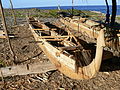
Fishing boat in Maquili

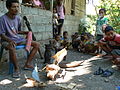
Fishermen in Maquili


-APiazza.JPG)


Diving area
Atauro is - with seven well-known diving spots around the island - the most pristine and one of the best diving areas in East Timor . The dive sites cover different levels of difficulty and offer good conditions with mostly very good visibility and a large number of schools of fish, but also turtles, large fish such as hammerhead sharks, as well as whales and dolphins. The intact coral reefs are suitable for both scuba divers and snorkelers.
Culture

Maquili is known for its wood carving skills. Originally they carved dance masks, male and female figures. There were also carvings of mermaids and eels , which are supposed to refer to the creation myth of the island. According to this, an eel that lived in the Banda Sea, known as the Women's Sea ( Tasi Feto ), is said to have created the island. Christianity influenced these animistic representations. So one began to cover the genitals of the figures with cloths and also to carve Christian motifs. Even today you can find masks on Atauro that hang on trees and are supposed to protect the gardens from thieves. Warriors and dancers also used the masks. Today they find new buyers as souvenirs.
Pottery has a long tradition in the interior of the island. However, the craft threatened to die out when in 2014 only two women over the age of 90 were able to master it. The knowledge was revived through an initiative, so that now around 25 women are again producing pots, so-called sanan rai .
Personalities
- Manuel Carrascalão (1933–2009), politician
- María do Céu (* 1957), human rights activist
- Cidália Lopes Nobre Mouzinho Guterres , First Lady of East Timor
- Ricardo Baptista (* 1982), politician
Web links
- Kim S. Ely, Mike Sandiford, Margaret L. Hawke, David Phillips, Mark Quigley, João Edmundo dos Reis: Evolution of Ataúro Island: Temporal constraints on subduction processes beneath the Wetar zone, Banda Arc , Journal of Asian Earth Sciences 41 (2011 ), Pp. 477-493
- Hinrich Kaiser u. a .: First Report on the Herpetofauna of Ataúro Island, Timor-Leste In: Check List 9 (4): 752–762, 2013 (PDF file).
- Gabrielle Samson: Australian editorial on Atauro's poverty (1999) ( Memento from February 23, 2005 in the Internet Archive )
- Colin R.Trainor and Thomas Soares: Birds of Atauro Island, Timor-Leste (East Timor)
- Wawata Topu - the Mermaids of Timor-Leste : Documentary ( Creative Commons 3.0 cc-by-nc-nd , also with German subtitles)
Individual evidence
- ↑ a b c d e Direcção-Geral de Estatística : Results of the 2015 census , accessed on November 23, 2016.
- ↑ Jornal da República : Diploma Ministerial no 24/2014 de 24 de Julho - Orgânica dos Postos Administrativos ( Memento of March 4, 2016 in the Internet Archive )
- ^ Colin Richard Trainor, Brian Coates, David K. Bishop: Aves de Timor-Leste. Burung-burung di Timor-Leste. The Birds of Timor-Leste , p. 66 (Portuguese, Indonesian, English)
- ↑ a b Kim S. Ely, Mike Sandiford, Margaret L. Hawke, David Phillips, Mark Quigley, João Edmundo dos Reis: Evolution of Ataúro Island: Temporal constraints on subduction processes beneath the Wetar zone, Banda Arc , Journal of Asian Earth Sciences 41 (2011), pp. 477-493, accessed October 25, 2015.
- ↑ UoM-East Timor project to map Atauro Iceland geology. In: UniNews Vol. 14, No. 9. University of Melbourne, May 30, 2005, archived from the original on June 22, 2005 ; Retrieved May 21, 2007 .
- ^ A b c d Colin R. Trainor and Thomas Soares: Birds of Atauro Island, Timor-Leste (East Timor) , Forktail 20 (2004), pp. 41-48
- ↑ a b Hinrich Kaiser u. a .: First Report on the Herpetofauna of Ataúro Island, Timor-Leste ( Memento of the original from March 14, 2016 in the Internet Archive ) Info: The archive link was inserted automatically and has not yet been checked. Please check the original and archive link according to the instructions and then remove this notice. In: Check List 9 (4): 752–762, 2013 (PDF file).
- ↑ a b Seeds of Life
- ↑ David Emmett: Dispatch from Atauro: Night Hikes, Bat Caves and a Trove of New Species , June 1, 2015 on Conversation International Blog , accessed March 22, 2017.
- ↑ Important Bird Areas in Timor-Leste ( Memento from November 22, 2008 in the Internet Archive ) (PDF file; 1.9 MB)
- ↑ Colin R. Trainor and Pedro J. Leitão: Further significant bird records from Atauro Island, Timor-Leste (East Timor) , Forktail 23 (2007), pp. 155–158
- ↑ a b Mark O'Shea et al. a .: Herpetological Diversity of Timor-Leste Updates and a Review of species distributions In: Asian Herpetological Research. 2015, 6 (2): 73-131., Accessed July 17, 2015.
- ^ The Guardian: Atauro Island: scientists discover the most biodiverse waters in the world , accessed on August 21, 2016.
- ↑ Ben Koses: Expedition draws world's attention to new crown jewel of marine life , in: humanature Conversation International blog , accessed on August 21, 2016.
- ↑ Ronald Fricke, Mark V. Erdmann: Helcogramma atauroensis, a new species of triplefin from Ataúro Island, Timor-Leste, eastern Indian Ocean (Teleostei: Tripterygiidae) , Journal of the Ocean Science Foundation, 26, 34–45 (2017), urn: lsid: zoobank.org: pub: 612DE10C-E89B-4C08-ADF9-598BC068B0AF doi: 10.5281 / zenodo.377034
- ↑ UCAN: Foreign Missioner Uses Traditional Medicine To Treat The Sick , December 13, 2007 , accessed December 18, 2017.
- ↑ Direcção Nacional de Estatística: 2010 Census Wall Chart (English) ( Memento of the original dated August 12, 2011 in the Internet Archive ) Info: The archive link was inserted automatically and has not yet been checked. Please check the original and archive link according to the instructions and then remove this notice. (PDF; 2.7 MB)
- ↑ Direcção Nacional de Estatística: Census of Population and Housing Atlas 2004 ( Memento of November 13, 2012 in the Internet Archive ) (PDF; 14 MB)
- ↑ Sapo Notícias: Ocupação humana em Ataúro data de há pelo menos 18 mil anos - arqueólogo , April 24, 2017 , accessed on May 3, 2017.
- ↑ Kisho Tsuchiya: Indigenization of the Pacific War in Timor Island: A Multi-language Study of its Contexts and Impact , pp. 14-17, Journal War & Society, Vol. 38, no. February 1, 2018.
- ^ Frédéric Durand: Three centuries of violence and struggle in East Timor (1726-2008) , Online Encyclopedia of Mass Violence
- ↑ Expresso: Última bandeira portuguesa de Timor está em Jacarta , June 27, 2015 , accessed on July 23, 2015.
- ↑ a b c d e Statement of Amnesty International's Concerns in East Timor , August 1983 ( Memento of the original from May 11, 2016 in the Internet Archive ) Info: The archive link was inserted automatically and has not yet been checked. Please check the original and archive link according to the instructions and then remove this notice. , from a letter from the Prime Minister of Vanuatu to the United Nations Security Council, November 30, 1983, Document S / 16215, December 14, 1983, retrieved May 11, 2016.
- ^ District Court of Dili: The Deputy General Prosecutor for Serious Crimes v. Victor Manuel Alves , accessed July 30, 2019.
- ↑ Jornal da República: Despacho No .: 31 / MAEOT / 2009 , accessed on January 20, 2018.
- ^ Government of Timor-Leste, September 3, 2010, The NSDP can be implemented according to the needs of the People
- ↑ Ministério da Administração Estatal: Administração Municipal ( Memento of the original from June 1, 2016 in the Internet Archive ) Info: The archive link has been inserted automatically and has not yet been checked. Please check the original and archive link according to the instructions and then remove this notice.
- ↑ RTTL: Administrador Postu Adm Atauro Husu Vice Ministru Saudae Loke Hospital Iha Atauro , January 13, 2018 , accessed on January 28, 2019.
- ↑ Facebook page of the Prime Minister's wife: Dra. Isabel da Costa Ferreira hala'o sorumutu ho Administrador posto Administrativo Atauro, iha Centro Quesadhip Ruak Taibesi Dili, January 28, 2018, accessed on January 28, 2019.
- ↑ a b c Tom Noble: Ethical tourism on an untouched island. In: The Sydney Morning Herald. April 17, 2005, accessed May 21, 2007 .
- ↑ Opening picture on Maf Timor-Leste's Facebook account , accessed on July 12, 2014
- ↑ Sapo.tl: Ilha de Ataúro, em Timor-Leste, vai ser eletrificada através de cabo submarino, July 18, 2013 , accessed on July 19, 2013
- ↑ LUSA: Lisbon funds USD 1.3 mn project to bring water to Ataúro Island , November 23, 2004 , accessed July 19, 2013
- ↑ Thomson Reuters Foundation: Remote island off East Timor turns sunlight, air into drinking water , December 13, 2019 , accessed December 27, 2019.
- ↑ Direcção Nacional de Estatística: Suco Report Volume 4 (English) ( Memento from April 9, 2015 in the Internet Archive ) (PDF; 9.8 MB)
- ↑ website of the documentary "WAWATA Topu - Mermaids of Timor-Leste" (with movie trailers).
- ↑ Ro'o Putin Hatin (The Boat from Putin's Place) , accessed on 16 January 2016th
- ↑ China Williams, Greg Bloom, Celeste Brash, Ian Stewart, Ryan Ver Berkmoes, Richard Waters, Stuart Butler, Shawn Low, Simon Richmond, Daniel Robinson: Lonely Planet Travel Guide to Southeast Asia for Little Money. Dumont, 2015, ISBN 978-3-8297-8544-0 , p. 587.
- ^ The Timor-Leste Coastal / Marine Habitat Mapping for Tourism and Fisheries Development Project, Project No 2, Coastal and Marine Ecotourism Values, Issues and Opportunities on the North Coast of Timor Leste, Final Report, October 2009 ( Memento from March 29, 2013 in the Internet Archive ) (PDF; 15.2 MB), accessed on December 28, 2012
- ↑ Timor-Leste, Eleições Gerais de 2012 , accessed on September 2, 2012
Coordinates: 8 ° 15 ′ S , 125 ° 35 ′ E
Atauro | Cristo Rei | Dom Aleixo | Metinaro | Nain Feto | Vera Cruz