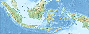
Timor Archipelago
| Timor Archipelago | ||
|---|---|---|
| Timor and its neighboring islands | ||
| Waters | Timor Sea , Banda Sea , Savu Sea | |
| archipelago | Lesser Sunda Islands | |
| Geographical location | 9 ° 14 ′ S , 124 ° 56 ′ E | |
|
|
||
| Main island | Timor | |
| Residents | 3,000,000 | |
The Timor Archipelago is the largest archipelago in the eastern Lesser Sunda Islands in the eastern part of the Malay Archipelago .
geography
The archipelago is named after the island of Timor , which is also the largest of the Lesser Sunda Islands. To the south of the Timor Archipelago lies the Timor Sea , to the northwest the Sawu Sea , and to the northeast the archipelago is separated from the Alor Archipelago by the Strait of Ombai and the Barat Daya Islands by the Strait of Wetar . The Timor Archipelago, together with the more remote islands of Sawu and Raijua , forms the western end of the outer banda arc , which extends further to the east with the neighbors Kisar (Indonesia) and the Leti Islands .
The main island of the archipelago is Timor , whose east and the exclave Oe-Cusse Ambeno in the north-west belong to the state of East Timor , as well as the small island of Jaco on the eastern tip of Timor. The island of Atauro, which belongs to East Timor and is located to the north, is closer to the islands of Liran and Wetar, which belong to the Barat Daya Islands, and is not part of the archipelago. The other half of Timor - like the rest of the islands in the archipelago - belongs to Indonesia . In front of Oe-Cusse Ambeno is the small island of Fatu Sinai , which was long disputed between the two states. On the western tip of Timor, across the Strait of Semau , lies the island of Semau with the smaller islands of Tabui and Kambang , at the entrance to the Bay of Kupang, the small island of Kera and Tikus , and a little to the southwest, across the Strait of Roti , the island of Roti with the islands of Ndao , Nuse (Nusa) and Doo offshore to the west , Usu , Nusa Manupui and Boti to the east, Ndoa , Nusa Kodi , Huana , Batuhun and Nusa Bibi to the north and Pamana (Dana, Dona, Ndana), Helihana , Landu , Manuk to the south-west , Batu Bibi , Liu , Nusa Nak and Lai .
The highest point of the archipelago is the Tatamailau in East Timor at 2963 m . The uninhabited island of Pamana is the southernmost point of Indonesia.
See also
Individual evidence
- ^ Map of Roti , accessed on February 10, 2016.
- ↑ Map of Roti ( Memento of the original from December 9th, 2015 in the Internet Archive ) Info: The archive link was inserted automatically and has not yet been checked. Please check the original and archive link according to the instructions and then remove this notice. , accessed March 17, 2013
- ^ Map of Roti ( Memento of December 16, 2010 in the Internet Archive ), accessed on March 17, 2013

