Fatu Sinai
| Fatu Sinai | ||
|---|---|---|
| Waters | Sawu Lake | |
| Archipelago | Timor Archipelago | |
| Geographical location | 9 ° 15 '24 " S , 123 ° 59' 35" E | |
|
|
||
| length | 500 m | |
| width | 320 m | |
| surface | 13.5 ha | |
| Highest elevation | 50 m | |
| Residents | uninhabited | |
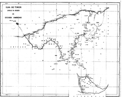
| Fatu Sinai off the coast of Oe-Cusse Ambeno | ||
Fatu Sinai (also called Pulau Batek ) is a small island off the northwest coast of Timor in the Sawu Sea . Following the settlement of the dispute over its affiliation with East Timor , the island belongs to Indonesia .
geography
Fatu Sinai is located 12 km off the coast of the East Timorese administrative office Nitibe (municipality Oe-Cusse Ambeno ), at the westernmost point of the country, or the Indonesian district ( Kecamatan ) of North Amfoang ( government district Kupang ). The closest localities are the East Timorese town of Citrana and the Indonesian village of Oepoli .
The island has an area of 13.5 hectares with a plateau that rises about 50 m above the sea. Contrary to the contrary information on some internet sites, Fatu Sinai is not a coral island .
meaning
The island is uninhabited, but is traditionally considered sacred by the local population on both sides of the border, even if the majority are now Christians. It is therefore called Fatu Lulik (holy mountain) or adat . Legend has it that the island came to its current position from the interior of Timor. While the inhabitants of Nitibe see their origin in East Timorese Oesilo , the people from North Amfoang assign the island's origin to the Indonesian Mutis , the highest mountain in West Timor . The legends are similar because despite the border from colonial times, the inhabitants of the region on both sides of the border belong to the Atoin Meto ethnic group .
history
The colonial era
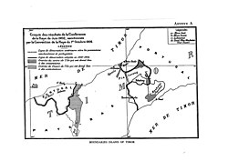
The border treaties between Portugal and the Netherlands in 1859, 1896, 1904 and 1914 established the border between the two domains of the colonial powers on the island of Timor . Only in the treaty of 1904 is the island mentioned as Pulau Batek , where it is divided between the Portuguese ( Portuguese Timor ) and the Dutch ( Dutch East Indies ). Later Fatu Sinai was a "forgotten island" that the colonial powers paid no further attention to. After the Indonesian invasion of East Timor in 1975, the island was anyway under Indonesian administration.
Dispute over the island
After the independence referendum of 1999 , in which East Timor opted for a state independent from Indonesia and later placed under UN administration, Fatu Sinai became a point of contention. In the first drafts of the Constitutional Commission of Oecussi Enclave , Fatu Sinai was defined, on the basis of several consultations with the municipalities, as part of Oe-Cusse Ambeno and thus as East Timorese territory. The East Timor Constitution , published in March 2002, did not list Fatu Sinai as part of the national territory.
In the second half of 2002 Indonesia built a small lighthouse on Fatu Sinai. On December 14, 2003, the Indonesian military carried out a military maneuver in which a warship, helicopter and jet fighter shot and bombed the island for several hours. The residents of Citrana , on the coast of Nitibe, felt threatened by this, especially since East Timor had not been informed of the maneuver beforehand. The government of East Timor and the United Nations withheld public comments, and the Australian press only reported on the incident on January 12, 2004. On February 5, Indonesian Colonel Moesanip , KOREM commander of Kupang , declared that the maneuver was intended to demonstrate Indonesian sovereignty over Fatu Sinai and, if East Timor resisted, Indonesia would deploy soldiers on the island.
As of January 2006, 97% of the border between East Timor and Indonesia was defined. In all border disputes, the local administration of Oe-Cusse Ambeno accused Indonesia of artificially creating disputes and of failing to comply with the 1914 treaty, which, according to the 2000 border committee agreement, should be the basis of the border demarcation. On August 19, 2004, Colonel Moesanip claimed that Foreign Minister Ramos-Horta had now waived Fatu Sinai for East Timor, but the government in Dili neither confirmed nor denied this claim. In the meantime, East Timor also seems to have officially given up its claims to the island.
Web links
supporting documents
- The conflict over Fatu Sinai from the point of view of Oe-Cusse Ambeno ( Memento from July 5, 2008 in the Internet Archive )
Individual evidence
- ^ Suara Timor Lorosae: Batugade and Suai borders have had agreement , March 11, 2013


