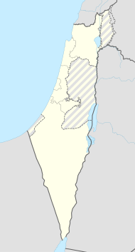
Nir David
| Nir David | ||
|---|---|---|
| Basic data | ||
| hebrew : | תל עמל | |
| arabic : |
ניר דוד |
|
| State : |
|
|
| District : | North | |
| Founded : | December 10, 1936 | |
| Coordinates : | 32 ° 30 ' N , 35 ° 27' E | |
| Height : | 103 m below sea level | |
| Residents : | 708 (as of 2018) | |
| Community code : | 0256 | |
| Time zone : | UTC + 2 | |
| Website : | ||
|
|
||
Nir David (נִיר דָּוִד Nīr Dawid , German 'Neuland Davids [Wolffsohn] ' ) and before 1940 Tel Amal (תֵל עָמָל Tel ʿAmal , German 'hill of effort' ; both names are common) is a kibbutz in the northern district of Israel west of Bet She'an at the foot of the Gilboa Mountains . The kibbutz had 708 inhabitants at the end of 2018.
history
Today it is one of the better known kibbutzim because it was the second Jewish settlement in Palestine to be established as the so-called " tower-and-palisade settlement " just three days after the first, Kfar Chittim . On December 10, 1936, it was built within one day from prefabricated parts with a tower and fortifications, so that it could be more easily defended against hostile non-Jewish Palestinians from the first night .
Today a museum on the kibbutz grounds commemorates the history of Tel Amal and the tower and palisade settlements in general. The kibbutz has its economic foundations, among other things, in agriculture and tourist facilities; The Gan HaSchloscha National Park is in the immediate vicinity .
Web links
- Website of Kibbutz (English)
- Gan Hashlosha
Individual evidence
- ↑ אוכלוסייה ביישובים 2018 (population of the settlements 2018). (XLSX; 0.13 MB) Israel Central Bureau of Statistics , August 25, 2019, accessed May 11, 2020 .
- ↑ אוכלוסייה ביישובים 2018 (population of the settlements 2018). (XLSX; 0.13 MB) Israel Central Bureau of Statistics , August 25, 2019, accessed May 11, 2020 .

