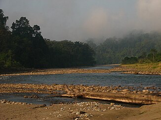
Noa-Dihing
| Noa-Dihing | ||
| Data | ||
| location | Arunachal Pradesh , Assam ( India ) | |
| River system | Brahmaputra | |
| Drain over | Lohit → Brahmaputra → Indian Ocean | |
| Headwaters | in the extreme southeast of Arunachal Pradesh 27 ° 5 ′ 49 ″ N , 97 ° 8 ′ 33 ″ E |
|
| Source height | approx. 3000 m | |
| muzzle |
Lohit coordinates: 27 ° 47 ′ 5 " N , 95 ° 40 ′ 46" E 27 ° 47 ′ 5 " N , 95 ° 40 ′ 46" E
|
|
| length | approx. 200 km | |
| Catchment area | approx. 3500 km² | |
| Small towns | Namsai | |
The Noa-Dihing is a left tributary of the Lohit in the Indian states of Arunachal Pradesh and Assam .
The Noa-Dihing rises on the border with Myanmar at the interface between the Patkai Mountains in the south and the Kachin Mountains , an eastern branch of the Himalayas , in the north. From there it flows in a predominantly west-northwest direction through the Changlang District and the newly created Namsai District . It flows through the Namdapha National Park . Not far from its right bank is the city of Namsai . It crosses the border with Assam and flows into the Lohit. The Noa-Dihing has a length of about 200 km.
Web links
Commons : Noa-Dihing - collection of pictures, videos and audio files
