Nushagak Peninsula
| Nushagak Peninsula | ||
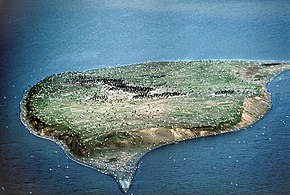
 Sea birds on an island off the peninsula |
||
| Geographical location | ||
|
|
||
| Coordinates | 58 ° 36 ′ N , 159 ° 0 ′ W | |
| Waters 1 | Bristol Bay ( Bering Sea ) | |
| length | 56 km | |
| width | 24 km | |
The Nushagak Peninsula ( English Nushagak Peninsula ) is located in southwest Alaska and is part of the Togiak National Wildlife Refuge .
The peninsula protrudes 35 miles into the northern Bristol Bay and reaches a width of up to 15 miles. To the east lies Nushagak Bay , into which the Nushagak River flows at Dillingham . In the west, the Kulukak Bay borders the peninsula, the southern tip is Cape Constantine . At the northern end is the Manokotak settlement , the peninsula itself is uninhabited.
The peninsula was named in 1910 by the US Coast and Geodetic Survey based on the adjacent bay.
