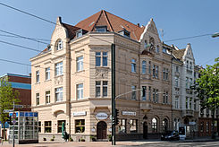
Oberbilker Allee
| Oberbilker Allee | |
|---|---|
| Street in Düsseldorf | |
| Oberbilker Allee 305 | |
| Basic data | |
| place | Dusseldorf |
| District | Friedrichstadt , Oberbilk |
| Connecting roads | Corneliusstrasse, Kölner Strasse |
| Cross streets | Keplerstrasse, Hildebrandtstrasse, Philipp-Reis-Strasse, Gustav-Poensgen-Strasse, Färberstrasse, Ringelsweide, Hüttenstrasse, Volksgartenstrasse, Höhenstrasse, Kruppstrasse, Borsigstrasse, Flügelstrasse, Emmastrasse, Kirchstrasse, Schmiedestrasse, Stoffeler Strasse, Siegburger Strasse |
| use | |
| User groups | Pedestrian traffic , bicycle traffic , car traffic , public transport |
| Technical specifications | |
| Street length | 2,000 m |
The Oberbilker Allee is a 2 km long east-west traffic axis in the North Rhine-Westphalian state capital Düsseldorf . It begins in the Friedrichstadt district of Düsseldorf and ends in Oberbilk . The road was formally paved on May 31, 1887.
Course and street description
The street begins at an intersection with Corneliusstraße as an extension of Bilker Allee . From here it runs eastwards as a four-lane main road to the intersection of Kölner Straße / Karl-Geusen-Straße where it continues as the latter. In the section between Hüttenstrasse and Philipp-Reis-Strasse, it passes under the Cologne – Duisburg and Mönchengladbach – Düsseldorf railway lines .
traffic
The Oberbilker Allee is crossed by several tram and light rail lines and some trams are used. Lines 701, 704 and 707 of the Rheinbahn cross Oberbilker Allee directly at the first crossing Corneliusstraße / Bilker Allee-Oberbilker Allee. The U74, U77 and U79 light rail lines pass under the street in the area of the Oberbilk S underground station , where the Düsseldorf-Oberbilk S-Bahn station is also located. It is used by line 705 on the section between the intersections with Hüttenstrasse and Kölner Strasse. Line 706 also crosses at the Kruppstraße junction.
Web links
Individual evidence
- ^ Hermann Kleinfeld: Düsseldorf's streets and their names. , P. 253, Grupello, Düsseldorf 1996, ISBN 3-928234-36-6
Coordinates: 51 ° 12 ′ 39 ″ N , 6 ° 47 ′ 36 ″ E
