Oga Peninsula
| Oga Peninsula | ||
 Landsat image of the Oga Peninsula |
||
| Geographical location | ||
|
|
||
| Coordinates | 39 ° 56 '0 " N , 139 ° 47' 0" E | |
| Waters 1 | Japanese sea | |
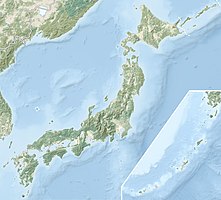
The Oga Peninsula ( Japanese 男 鹿 半島 , Oga-hantō ) is a peninsula in Japan . It is located on the west coast of the main island of Honshu in Akita Prefecture and extends west into the Sea of Japan . Most of the peninsula belongs to the city of Oga .
geography
Originally Oga was an island, but due to the material transport of the rivers Yoneshiro ( 米 代 川 , Yoneshiro-gawa ) and Omono ( 雄 物 川 , Omono-gawa ), a tombolo now connects the island core with Honshū. The highest elevation of 354 m is the stratovolcano Kampů ( 寒風山 , Kampů-zan , literally "Cold Wind Mountain").
The southeast coast consists of cliffs . On the eastern edge of the peninsula is the lake Hachirogata , which was formerly the second largest lake in Japan. The Ichinomegata ( 一 ノ 目 潟 ), Ninomegata ( 二 ノ 目 潟 ) and Sannomegata ( 三 ノ 目 潟 ) lakes are Japan's only maars . The Toga Bay ( 戸賀湾 , toga-wan ) (also Shinomegata ( 四ノ目潟 )) is just such a crater.
Culture
Oga is famous for its traditional Namahage festival .
Mayama ( 真 山 ), Motoyama ( 本 山 ) and Kenashiyama ( 毛 無 山 ), the "Three Mountains of Oga" ( 男 鹿 三 山 , Oga-sanzan ) are consecrated places of religious mountain worship ( 山岳 信仰 , sangaku shinkō ).
tourism
Thermal springs such as the Onsen Oga ( 男 鹿 温泉 郷 , Oga onsenkyō ), Kanesaki ( 金 崎 ) or Toga ( 戸 賀 ) line the coast . The cape Nyudo ( 入道崎 , Nyudo-saki ) on the north west side is a Abrasionskliff; there is the lighthouse Cape Nyūdō ( 入道 埼 灯台 , Nyūdō-saki tōdai ). Parts of the peninsula belong to the Oga Quasi National Park .
Web links
- Interactive map of the peninsula (Japanese)
