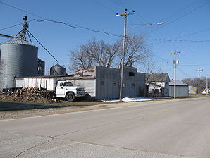
Orchard, Iowa
| Orchard | ||
|---|---|---|
 |
||
| Location in Iowa | ||
|
|
||
| Basic data | ||
| State : | United States | |
| State : | Iowa | |
| County : | Mitchell County | |
| Coordinates : | 43 ° 14 ′ N , 92 ° 46 ′ W | |
| Time zone : | Central ( UTC − 6 / −5 ) | |
| Residents : | 88 (status: 2000) | |
| Population density : | 440 inhabitants per km 2 | |
| Area : | 0.2 km 2 (approx. 0 mi 2 ) | |
| Height : | 336 m | |
| Postal code : | 50460 | |
| FIPS : | 19-59520 | |
| GNIS ID : | 0459886 | |
Orchard is a city in Mitchell County in the northeast of the US state Iowa . Orchard has 88 inhabitants on an area of 0.2 km². It is connected to the railway network and has a connection to the IA 218 . Orchard is a few miles south of the county seat Osage near Idlewild State Park .
