Oredesch
|
Oredesch Оредеж |
||
| Data | ||
| Water code | RU : 01030000512102000025828 | |
| location | Leningrad Oblast ( Russia ) | |
| River system | Luga | |
| Drain over | Luga → Baltic Sea | |
| origin |
Kjurlewski Karjer 59 ° 25 '26 " N , 29 ° 47' 6" O |
|
| muzzle |
Luga coordinates: 58 ° 48 ′ 42 " N , 29 ° 58 ′ 37" E 58 ° 48 ′ 42 " N , 29 ° 58 ′ 37" E
|
|
| length | 192 km | |
| Catchment area | 3220 km² | |
| Outflow location: 36 km above the mouth |
MQ |
20 m³ / s |
| Small towns | Siwerski , Wyriza | |
| Communities | Oredesch | |
|
Course of the Oredesch (Оредеж) in the catchment area of the Luga |
||
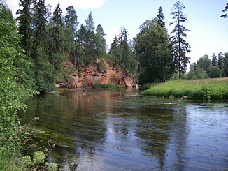
The Oredesch ( Russian Оредеж ) is a right tributary of the Luga in the Russian Oblast of Leningrad .
The Oredesch has its origin in the pond Kjurlewski Karjer . It initially flows in an arc to the east, past the urban-type settlements of Siwerski and Wyritsa , later to the south and finally to the west. It meets the upper reaches of the Luga, a tributary of the Gulf of Finland . The town of the same name Oredesch is not far from the estuary on the southern bank of the river.
The Oredesch has a length of 192 km. It drains an area of 3220 km². 36 km above the mouth, the mean discharge is 20 m³ / s. Between the second half of November and the first half of January, the river freezes. In April it will be ice-free again.
The Oredesch is navigable in the lower reaches .

