Orzyc
|
Orzyc Orzycz, Orzyca, Orschütz |
||
|
The Orzyc |
||
| Data | ||
| location | Masovian Voivodeship , Warmian-Masurian Voivodeship , Poland | |
| River system | Vistula | |
| Drain over | Narew → Vistula → Baltic Sea | |
| source | east of Mława | |
| muzzle | at Przeradowo in the Narew coordinates: 52 ° 46 ′ 0 ″ N , 21 ° 12 ′ 0 ″ E 52 ° 46 ′ 0 ″ N , 21 ° 12 ′ 0 ″ E
|
|
| length | 146 km | |
| Catchment area | 2077 km² | |
| Left tributaries | Grabowski Rów, Baranowska Struga | |
| Right tributaries | Tamka, Bobrynka, Ulatówka , Bramura, Węgierka | |
| Small towns | Chorzele , Maków Mazowiecki | |
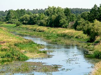
The Orzyc [ ˈɔʒɨt͡s ] (German Orschütz) is a right tributary of the Narew in Poland .
geography
The Orzyc rises east of Mława in the border area of the Warmian-Masurian Voivodeship and the Masovian Voivodeship , flows first in a north-north-east and then in a south-east direction, flows through Chorzele , turns south and passes through Maków Mazowiecki . At Przeradowo it flows into the Narew after a run of 146 km. Its catchment area is given as 2077 km².
