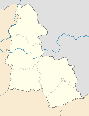
Otschkyne
| Otschkyne | ||
| Очкине | ||

|
|
|
| Basic data | ||
|---|---|---|
| Oblast : | Sumy Oblast | |
| Rajon : | Seredyna-Buda district | |
| Height : | 130 m | |
| Area : | Information is missing | |
| Residents : | 509 (2004) | |
| Postcodes : | 41040 | |
| Area code : | +380 5451 | |
| Geographic location : | 52 ° 14 ' N , 33 ° 23' E | |
| KOATUU : | 5924484401 | |
| Administrative structure : | 1 village | |
| Address: | 41040 с. Очкине | |
| Statistical information | ||
|
|
||
Otschkyne ( Ukrainian Очкине ; Russian Очкино Otschkino ) is a village in the northwest of the Ukrainian Sumy Oblast with about 500 inhabitants (2004).
Geographical location
The village is located on the left bank of the Desna , which is very winding here and therefore has many oxbow lakes and wetlands. The Seredyna-Buda district center is 52 km east and the Sumy oblast center 245 km southeast of Otschkyne.
local community
Until 2016, Otschkyne was the administrative center of the district council of the same name in the west of Seredyna-Buda Rajon with a total of around 840 inhabitants. The municipality next Otschkyne nor the villages were Schurawka ( Журавка , ⊙ ) with about 310 inhabitants and Krasnojarske ( Красноярське , ⊙ ) with about 20 inhabitants. Since August 30, 2016, the village has been part of the Snob-Nowhorodske settlement community .
Individual evidence
- ^ Website of the village on the website of the Verkhovna Rada , accessed on June 7, 2017 (Ukrainian)
- ↑ Відповідно до Закону України "Про добровільне об'єднання територіальних громад" у Сумській області у Середино-Будському районі Зноб-Новгородська селищна, Голубівська, Зноб-Трубчевська, Кренидівська, Кривоносівська, Нововасилівська, Очкинська і Стягайлівська сільські ради рішеннями від 29 та 30 серпня 2016 року об'єдналися у Зноб-Новгородську селищну територіальну громаду

