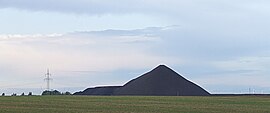
Otto Brosowski shaft
| Otto Brosowski shaft | |||
|---|---|---|---|
| General information about the mine | |||
| other names | Paulschacht | ||
| Mining technology | Longwall mining | ||
| Information about the mining company | |||
| Operating company | VEB Mansfeld Kombinat Wilhelm Pieck | ||
| Employees | 3000 (1927) | ||
| Start of operation | 1900 | ||
| End of operation | 1969 (1970 - drainage, underground dismantling) | ||
| Successor use | Mixed trade | ||
| Funded raw materials | |||
| Degradation of | Copper slate (copper, silver, other precious and rare metals) | ||
| Mightiness | 0.4 m | ||
| Raw material content | 2% | ||
| Greatest depth | 829.7 m | ||
| Geographical location | |||
| Coordinates | 51 ° 36 '18.4 " N , 11 ° 35' 27.2" E | ||
|
|||
| Location | Augsdorf | ||
| local community | Gerbstedt | ||
| District ( NUTS3 ) | Mansfeld-Südharz | ||
| country | State of Saxony-Anhalt | ||
| Country | Germany | ||
| District | Mansfeld district | ||
The Otto-Brosowski shaft is located northeast of the village of Augsdorf and, along with the Ernst-Thälmann shaft (130 m) and the progress shaft I (153 m), was one of those large shafts in the Mansfeld district where a cone pile (104 m) was raised. one of the so-called pyramids of the Mansfeld country .
The mine was named after the communist Otto Brosowski from Gerbstedt , whose wife hid the Krivoy Rog flag from the National Socialists.
history
Under the original name Paul Schacht he was from 1900 to 1906 at 572.5 meters drilled . In 1948/49 the shaft was sunk to 829.7 meters and was then the deepest shaft in the Mansfeld district.
The shaft mined in the years from 1908 to 1927, whereby in 1913 the strength of the workforce reached its maximum with more than 3,000 men. In 1937 the production started again and continued until the end of the war. Immediately after the war, the workforce was 1,166 and fluctuated between 2,000 and 2,500 until the end of the subsidy in 1969.
The shaft caused a sensation twice due to water ingress. The first water ingress occurred on March 9, 1952 between the 7th and 8th level, while the second ingress occurred on September 17, 1958 in the crosscut of the 5th level. With an inflow of 15,000 to 20,000 liters / min, this was the heaviest in the 770-year history of the Mansfeld copper mining. The lives of 63 miners were in acute danger. They were only able to save themselves by walking up to 15 hours on foot, which took them on long detours to the neighboring Niewandtschacht about 3 km away .
The last shift on the Otto-Brosowski-Schacht was driven on December 12, 1969 and at the same time meant the end of mining in the Mansfeld district.
From then on, the surface systems served u. a. as production facilities for telecommunications equipment. Furthermore, here was the Research Department of the Directorate technique of Mansfeld-Kombinat Wilhelm Pieck based.
After the end of the GDR , an industrial park was built on the site.
literature
- Günter Jankowski: Important copper slate shafts in the Mansfeld Mulde . 2nd edition 1987
- Mansfelder Land (= values of our homeland . Volume 38). 1st edition. Akademie Verlag, Berlin 1982.
- Association of Mansfeld Miners and Huts Association and Mining Museum Bochum (ed.): Mansfeld - The history of mining and metallurgy. Lutherstadt Eisleben and Bochum 1999, ISBN 3-921-533-69-4 .
- Here the Harz and there the Saale - the Mansfeld region . Multimedia foray through Martin Luther's homeland. Multimedia CD-ROM. Schneemann, Berlin undated, ISBN 3-00-009782-1 .
Web links
Individual evidence
- ↑ collective of authors; Horst Roschlau, Hans-Joachim Haberkorn (Hrsg.): Geological basic knowledge , 2nd edition, Deutscher Verlag für Grundstoffindustrie, Leipzig 1977, p. 145


