Owambo (river)
| Owambo | ||
|
Owambo (bottom right) |
||
| Data | ||
| location |
Oshikoto , Namibia |
|
| River system | Omuramba Ovambo | |
| source | 25 km of SO Tsintsabis 18 ° 50 '11 " S , 18 ° 10' 39" O |
|
| muzzle |
Etosha pan coordinates: 18 ° 44 ′ 21 ″ S , 17 ° 1 ′ 42 ″ E 18 ° 44 ′ 21 ″ S , 17 ° 1 ′ 42 ″ E
|
|
| length | 150 km | |
| Catchment area | 19,426 km² | |
| Left tributaries | Nugames | |
| Navigable | No | |
| Omuramba (dry river) | ||
|
Owambo (2019) |
||
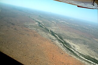
The Owambo ( English also Ovambo ) is an Omuramba of the Omuramba Ovambo river system in the central north of Namibia . As a dry river , it carries water very irregularly, most recently in 2017. It is around 150 kilometers long.
The Owambo, based on the people of the same name in whose peripheral settlement area it is located, rises about 25 kilometers southeast of Tsintsabis , flows west, passes Oshivelo in the south and flows into the Etosha Pan in the Etosha National Park . Its catchment area covers 15,783,756 square kilometers . It drains the Karstveld .
literature
- A. Spriggs: Etosha Pan halophytics. WWF, 2001.
- Greg Christelis, Wilhelm Struckmeier: Groundwater in Namibia an explanation to the Hydrogeological Map. Ministry of Agriculture, Water and Rural Development, January 2011. ( PDF )
Individual evidence
- ↑ Omuramba-Ovambo, Okavango-South Interior. River network. Retrieved August 18, 2020.
- ↑ Dirk Heinrich: Omuramba Ovambo slowly moves towards Etosha. Gondwana Collection Namibia, March 14, 2017.
- ^ Ben J. Strohbach: Mapping the Major Catchments of Namibia. National Botanical Research Institute, date unknown , p. 5.

