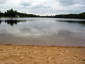
Oyter lake
| Oyter lake | ||
|---|---|---|

|
||
| View from the northeast | ||
| Geographical location | Oyten , Verden district , Lower Saxony | |
| Places on the shore | Oyten | |
| Location close to the shore | Bremen | |
| Data | ||
| Coordinates | 53 ° 2 '40 " N , 8 ° 59' 49" E | |
|
|
||
| Altitude above sea level | 5 m | |
| surface | 23 hectares | |
| length | 1 km | |
| width | 400 m | |
| scope | 3 km | |
| Maximum depth | 14 m | |
|
particularities |
||
The Oyter Lake is a quarry pond in the town of Oyten in the district of Verden , Lower Saxony .
description
The lake has a length of about one kilometer and a maximum width of about 400 meters, its maximum depth is 14 meters. It is located directly on the Bremer Kreuz and was created in the 1930s through soil removal for the construction of the motorway . When viewed from the air, the characteristic shape of an L can be seen.
Surrounded mainly of woody held lake is within the protected landscape "Highway Stretch in Oyten" and serves as a recreational area . It can be circled on an approximately three-kilometer circular route. The bathing area with a beach and a lawn for sunbathing is located on the eastern shore of the lake. The bathing area is opened during the bathing season by the water rescue service of the German Red Cross District Association Verden e. V. guarded and examined by the district of Verden in the water laboratory every four weeks. On the east bank there is also a campsite with parking spaces for mobile homes and an area with mobile homes .
The Embser Mühlengraben runs west of the lake . This rather nutrient-loaded trench was previously connected to the lake. Due to the nutrient input into the eutrophic lake, blue-green algae bloom increased in the 1980s , whereupon the flow into the lake was interrupted.
The lake is used by the anglers' association Achim eV as fishing waters.
Picture gallery
See also
Web links
- Oyter See , Bathing Water Atlas Lower Saxony
Individual evidence
- ↑ Oyter See Angelwahn.de, accessed on December 6, 2019.
- ↑ Landscape protection areas (LSG) , Verden district. Retrieved December 6, 2019.
- ^ Oyter See , municipality of Oyten. Retrieved December 6, 2019.
- ↑ Wasserwacht , German Red Cross, Verden district association. V. Accessed December 6, 2019.
- ↑ Bathing water quality , Verden district. Retrieved December 6, 2019.
- ↑ Waters in the permit , Angler-Verein Achim e. V. Accessed December 6, 2019.


