Ozark, Alabama
| Ozark | |
|---|---|
 Claybank Log Church (2016) |
|
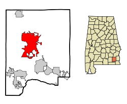
| Location in County and Alabama | |
| Basic data | |
| Foundation : | 1822 |
| State : | United States |
| State : | Alabama |
| County : | Dale County |
| Coordinates : | 31 ° 27 ′ N , 85 ° 38 ′ W |
| Time zone : | Central ( UTC − 6 / −5 ) |
| Residents : | 15,119 (as of: 2000) |
| Population density : | 170.5 inhabitants per km 2 |
| Area : | 89.3 km 2 (approx. 34 mi 2 ) of which 88.7 km 2 (approx. 34 mi 2 ) are land |
| Height : | 127 m |
| Postcodes : | 36360-36361 |
| Area code : | +1 334 |
| FIPS : | 01-57648 |
| GNIS ID : | 0152832 |
| Website : | www.ozarkalabama.org |
| Mayor : | Billy Blackwell |
Ozark is a city in the US state of Alabama . In 2000 the city had 15,119 inhabitants. The city is located in Dale County and is its county seat .
history
The area around Ozark was originally settled by Indians from the Muskogee tribe. The first white man to settle in Ozark, whose name is known, was John Merrick Sr., a veteran of the American Revolutionary War , in 1822 . The city of Merricks was named in his honor. The name was later changed to Woodshop, which was the name of the town when it received a post office. In 1855 the residents demanded the name change to Ozark.
When the Newton county's courthouse burned down, a vote was held to determine a new county seat from which Ozark emerged victorious. The city was incorporated in 1870.
Three structures in Ozark are listed on the National Register of Historic Places (NRHP) as of October 23, 2019, including the Blair-Dunning House .
geography
Ozark's geographic coordinates are 31 ° 27 ' N , 85 ° 39' W (31.448169, −85.642009).
According to the United States Census Bureau , the city has an area of 89.3 km², of which 88.7 km² is land and 0.6 km² (= 0.70%) is water.
Demographics
At the time of the 2000 United States Census, Ozark was inhabited by 15,119 people. The population density was 170.5 people per km ². There were 6955 housing units at an average of 170.5 per km². The Ozark population was 68.28% White , 28.30% Black or African American , 0.67% Native American , 0.70% Asian , 0.05% Pacific Islander , 0.46% said other races belong to and 1.53% named two or more races. 2.08% of the population declared to be Hispanic or Latino of any race.
The residents of the Ozark were distributed to 6126 households out of which 31.4% had children under the age of 18. 48.8% of households were married, 16.9% had a female head of the household without a husband and 30.9% were not families. 27.7% of households were made up of individuals and someone lived in 10.6% of all households aged 65 years or older. The average household size was 2.40 and the average family size was 2.92.
The urban population was distributed among 24.9% minors, 8.5% 18–24 year olds, 26.0% 25–44 year olds, 24.7% 45–64 year olds and 15.9% aged 65 and over or more. The median age was 39 years. For every 100 women there were 87.8 men. For every 100 women over 18, there were 83.4 men.
The median household income in Ozark was 29,330 US dollars and the median family income reached the amount of 38,633 US dollars. The median income for men was $ 30,236, compared with $ 19,564 for women. The per capita income in Ozark was $ 15,984. 19.0% of the population and 14.8% of families had an income below the poverty line , including 27.0% of minors and 18.0% of those aged 65 and over.
Remarks
-
↑ Search mask database in the National Register Information System. National Park Service , accessed October 23, 2019.
Weekly List on the National Register Information System. National Park Service , accessed October 23, 2019.
