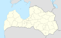
Ozolnieki
| Ozolnieki | ||
|---|---|---|
 Help on coat of arms |
|
|
| Basic data | ||
| State : |
|
|
| Landscape: | Semgallia ( Latvian : Zemgale ) | |
| Administrative district : | Ozolnieku novads | |
| Coordinates : | 56 ° 41 ' N , 23 ° 47' E | |
| Residents : | 4,304 (Jun 3, 2015) | |
| Area : | ||
| Population density : | ||
| Height : | 3 m | |
| Website: | www.ozolnieki.lv | |
| Post Code: | ||
| ISO code: | ||
Ozolnieki (Eng. Paulsgnade) is a place in Latvia , about 36 km southwest of Riga and 6 km east of Jelgava (Eng. Mitau). In 2015 Ozolnieki had around 4,300 inhabitants.
history
The place arose around a manor , which was intended from 1605 to 1704 to care for the widows of the dukes of Courland and Semigallia . After the land reform in 1920 it was expropriated and divided into 252 parts for new settlers. In 1929 its own train station was opened on the Riga – Jelgava (Mitau) line. The village grew particularly after a factory for drainage machines was built here in 1950.
Ozolnieku novads
Ozolnieku novads (German area Paulsgnade) was created in 2003 through the union with the community of Cena (German Zennhof). In 2009 Sidrabene was added. In 2009, 10,237 residents were registered.
literature
- Hans Feldmann , Heinz von zur Mühlen (ed.): Baltic historical local dictionary, part 2: Latvia (southern Livonia and Courland). Böhlau, Cologne 1990, ISBN 3-412-06889-6 , p. 455.
- Astrīda Iltnere (ed.): Latvijas Pagasti, Enciklopēdija. Preses Nams, Riga 2002, ISBN 9984-00-436-8 .
Individual evidence
- ↑ Latvijas Ģeotelpiskās informācijas aģentūra (LGIA): Vietvārdu datubāze (database of place names), edition of September 30, 2015 (Latvian).
- ↑ Hans Feldmann, Heinz von zur Mühlen (ed.): Baltic historical local dictionary, part 2: Latvia (southern Livland and Courland). Böhlau, Cologne 1990, p. 455.

