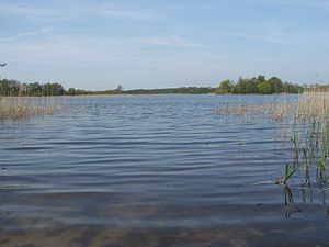
Pütter See
| Pütter See | ||
|---|---|---|

|
||
| Geographical location | District of Western Pomerania-Rügen | |
| Tributaries | Mühlgraben from Borgwallsee | |
| Drain | Mühlgraben to the moor pond | |
| Places on the shore | Bag | |
| Location close to the shore | Langendorf , Pantelitz , Stralsund | |
| Data | ||
| Coordinates | 54 ° 17 '46 " N , 12 ° 59' 30" E | |
|
|
||
| Altitude above sea level | 13 m above sea level NHN | |
| surface | 49 hectares | |
The Pütter See is a lake in the municipality of Lüssow in the Vorpommern-Rügen district . It is located directly northeast of the village of Pütte in the municipality of Pantelitz . The water is part of the nature reserve Borgwallsee and Püttersee .
It is named after the district of Pütte in the municipality of Pantelitz , which is located on the western shore of the lake. The west bank of the lake is the municipal boundary. The Pütter See is 600 meters north of the Borgwallsee , from which the inflow is via the Mühlgraben. In the north the lake flows over the Mühlgraben towards the Stralsund Moorteiches and in the southwest the lake drains over the Pütter Moor to the Barthe . The railway line and the 105 federal road from Rostock to Stralsund are 200 meters north of the bank . The banks are almost completely covered with reeds, in the southern third there is a small, wooded island (Die Werder) of 0.3 hectares. The lake has a north-south extension of about 1100 meters and a west-east extension of about 500 meters.
The lake was originally connected to the Borgwallsee by a 17 meter deep connection , which was filled with digested sludge and peat.
