Pama (Burkina Faso)
| Pama | ||
|---|---|---|
| Status: | commune urbaine | |
| Region: | Est | |
| Province: | Kompienga | |
| Surface: | ||
| Residents: | 36.503 | |
| Population density: | ||
| Structure: | 4 arrondissements / 14 villages | |
| Mayor: | Aimé Maxime Onadja | |
| Prefect: | Saidou Sawadogo | |
| location | ||
|
|
||
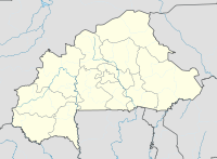
Pama is a small town (commune urbaine) and a department encompassing the same area in the south-east of the West African state of Burkina Faso in the Est region and the capital of Kompienga Province . The main town, which is divided into four sectors, and its 14 villages (Bombontangou, Folpodi, Kabonga I, Kabonga II, Kalmama-Signoghin, Koalou, Kompiembiga, Kpadiari, Nadiagou, Niorgou I, Niorgou II, Oumpougdéni, Tibadi and Tindangou) have a total of 36,503 inhabitants . Pama is on the road between Fada N'Gourma and the border with Benin , which is also a transhumance track for cattle from northern Burkina towards the coastal countries. To the east lies the nature reserve Réserve partial de Pama , to the west of the Kompienga reservoir .
Pama has an airport with the international identification XPA.
According to the legend, Diaba Lompo , first king of the gourmantché , rode out of the clouds here and made Pama the first capital of the Gulmu Empire .
Web links
- Monograph of the city of Pama (French)
- Topographic map of the Pama region
- African Protected Areas Report on the Reserve de Pama
- DED Transhumance Study , p. 48 ff. And p. 76
Individual evidence
- ↑ Preliminary results of the 2006 census (PDF; 3.3 MB)
- ↑ Council of Ministers, July 26, 2006 ( Memento of the original from October 6, 2007 in the Internet Archive ) Info: The archive link was automatically inserted and not yet checked. Please check the original and archive link according to the instructions and then remove this notice.
Coordinates: 11 ° 14 ' N , 0 ° 43' E


