Pauhunri
| Pauhunri | ||
|---|---|---|
| height | 7128 m | |
| location | Sikkim ( India ), Tibet Autonomous Region ( PR China ) | |
| Mountains | Dongkya group ( Himalayas ) | |
| Dominance | 66.43 km → Kirat Chuli | |
| Notch height | 2035 m | |
| Coordinates | 27 ° 57 '9 " N , 88 ° 50' 33" E | |
|
|
||
| First ascent | June 14, 1911 by Alexander Mitchell Kellas and two Sherpas | |
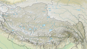
The Pauhunri is a mountain in the Himalayas on the border between Sikkim in India and Tibet in China .
The Pauhunri has a height of 7128 m . It is located in the eastern main Himalayan ridge in the northeast of Sikkim. The mountain lies on a ridge running in a north-south direction, which forms the watershed between the upper reaches of the Brahmaputra and the Tista , which flows into the lower reaches of the Brahmaputra. The eastern flank of Pauhunri is in Tibet and the Tibetan lake Duoqing Co drained out. The western flank of the Pauhunri in Sikkim, on the other hand, forms the headwaters of the Lachen Chu , the right headwaters of the Tista.
The Pauhunri was first climbed on June 14, 1911 by the Scottish mountaineer Alexander Mitchell Kellas and two Sherpas and was later determined to be the highest peak climbed between 1910 and 1928. The ascent route led from the Tibetan side over the northeast face to the summit.
Web links
- Pauhunri on Peakbagger.com (English)
Individual evidence
- ^ AAJ: Asia, India, Sikkim Himalaya, Northern Sikkim, Various Ascents
- ↑ http://caledonianmercury.com: Scottish climber revealed to be altitude record-breaker - 80 years on ( Memento of the original from May 24, 2014 in the Internet Archive ) Info: The archive link was automatically inserted and not yet checked. Please check the original and archive link according to the instructions and then remove this notice.
- ^ Alpine Club Library - Himalayan Index
