Pernis
 flag |
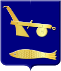
 coat of arms |
| province |
|
| local community |
|
|
Area - land - water |
1.62 km 2 1.58 km 2 0.04 km 2 |
| Residents | 4,785 (Jan 1, 2017) |
| Coordinates | 51 ° 53 ' N , 4 ° 23' E |
| Important traffic route |
|
| prefix | 010 |
| Postcodes | 3195-3196 |
| Location of Pernis in the municipality of Rotterdam | |
Pernis is a village in the urban area of Rotterdam with 4,785 inhabitants (as of January 1, 2017). The village of 1.6 km² is located in the middle of the port facilities on the Nieuwe Maas, isolated from the rest of the residential development and has thus retained a relatively village-like character.
Pernis was founded as a farming village probably in the 14th century, the inhabitants also began a successful salmon fishery in the 19th century, going all the way to Iceland . In 1934 the village was incorporated into expanding Rotterdam. Extensive port facilities were built around Pernis, including the Eemhaven with container terminals and the first and second oil ports in which there are gigantic refineries, including those from Shell , and for which the name Pernis is primarily known internationally.
Probably because of its isolation, Pernis only has an allochton population of 7% and is thus far below the average of 46% in Rotterdam as a whole. A connection to the local public rail transport has only existed since 2002, when the Rotterdam Metro opened the Pernis station on the new Benelux line.
Web links
Individual evidence
- ↑ a b Kerncijfers wijken en buurten 2017 Centraal Bureau voor de Statistiek , accessed on June 10, 2018 (Dutch)

