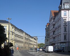
Peterssteinweg
| Peterssteinweg | |
|---|---|
| Street in Leipzig | |
| Peterssteinweg (2011) | |
| Basic data | |
| place | Leipzig |
| District | Center-South |
| Hist. Names | Zeitzer Strasse |
| Connecting roads |
Martin-Luther-Ring , Wilhelm-Leuschner-Platz , Karl-Liebknecht-Straße |
| Cross streets | Nonnenmühlgasse, Dimitroffstrasse, Strasse des 17. Juni, Härtelstrasse, Emilienstrasse |
| use | |
| User groups | Pedestrian traffic , car traffic , public transport |
| Technical specifications | |
| Street length | 0.27 km |
The Peterssteinweg is a main road in the Leipzig district center-south . The extension of the Peterssteinweg to the south forms the Karl-Liebknecht-Straße
The 270 meter long Peterssteinweg, which runs south from Wilhelm-Leuschner-Platz or the inner city ring to Emilienstraße, was named after the Peterstor , where the street formerly led out of the old town. As a continuation of Peterstraße, Peterssteinweg was a small part of the old street Via Imperii , the former north-south trade route that led from Peterstor through what is now the Inner Südvorstadt and the Südvorstadt via Connewitz to Nuremberg .
In contrast to most of the other streets in Leipzig, the Peterssteinweg was once a stone paved street. In Leipzig there was only such a road surface in Peterssteinweg , Ranstädter Steinweg and Grimmaischer Steinweg .
The Roman House, built between 1832 and 1834 by the music publisher Hermann Härtel (1803–1875), once stood opposite the confluence with Münzgasse . After several changes of ownership, it was demolished in 1904 in order to be able to cross the Härtelstraße, named after Hermann Härtel, to the Peterssteinweg.
The editorial office of the formerly important newspaper of the labor movement and now the local daily Leipziger Volkszeitung has been located in Peterssteinweg since 1945 . Next there was the until its closure in 2006 includes original specialist drugstore Left and also until its closure in 2009, a branch of the Berlin Kölsch -Kneipe " Permanent Representation " in the erected on the site of the former restaurant "Peter Schießgraben" Gründerzeit Münzblock.
At the confluence with Martin-Luther-Ring stands the provost church of St. Trinitatis, newly built in 2015 .
- Buildings on Peterssteinweg
literature
- Gina Klank, Gernot Griebsch: Lexicon of Leipzig street names . 1st edition. Verlag im Wissenschaftszentrum, Leipzig 1995, ISBN 3-930433-09-5 , p. 166 .
Web links
Coordinates: 51 ° 19 ′ 58 ″ N , 12 ° 22 ′ 24.6 ″ E


