Pfannenstein (Deidesheim)
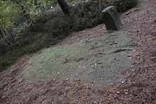
The Pfannenstein , also called Forster Pfann , is a Loogfels - a rock on which special notches were made to mark a border. It is a three-mark Loogfels, here the district boundaries of the cities of Deidesheim and Wachenheim an der Weinstrasse , as well as the community of Forst an der Weinstrasse converge. The Pfannenstein is listed as an individual monument in the state of Rhineland-Palatinate's list of monuments and is the oldest boundary stone in the Palatinate based on the date inset .
location
The Pfannenstein is located in the Palatinate Forest , about 2.8 km west of Forst on the Weinstrasse, right next to a hiking trail. The summit of the Eckkopf is about 1 km to the southwest . The Pfannenstein marks the northern border of Deidesheim, the southern border of Wachenheim and the western border of Forst. About 140 m to the southeast there is another border rock, the Loogfels No. 203 .
Surname
The Loogfels owes its name to pan-like weathering bowls, also called "soup bowls" in the Palatinate. In old descriptions it was called "Pfannenstein", in one from 1705 it was also called "Forster Pfann". He was the godfather for the field name “Pfannenstich” at the upper end of the Forster valley.
Designations
The following signs are embedded on the rock:
- O is a numbering letter
- The large cross stands for the Speyer bishop , who was formerly the sovereign of Deidesheim and Forst
- The simple, small cross is the Forster boundary symbol
- The cross extended by a small crossbar is the Deidesheimer Waldloogzeichen, according to a document from 1528
- The diamond coat of arms stands for Wachenheim
- Z0 is a Deidesheim landmark number
In addition, monograms and the dates 1488, 1784, 1789 and 1818 are notched. Shoe prints have been carved on the upper left edge. They point in the direction in which the border runs. The classical scholar Jacob Grimm suspected that footprints or shoe prints on boundary stones indicate an internal division of the country. This is probably true here, because this is where the border between the third and fourth Haardtgeraide used to run .
Web links
Individual evidence
- ↑ Otto Gödel: boundary stones - district and goods stones and their creation . In: Heimatfreunde Deidesheim und Umgebung (Hrsg.): Heimatblätter Deidesheim und Umgebung . No. 5 , 1972, p. 4 .
- ^ General Directorate for Cultural Heritage Rhineland-Palatinate (ed.): Informational directory of cultural monuments - Bad Dürkheim district. Mainz 2020, p. 26 (PDF; 5.1 MB; see: Loogfels No. 202 in the Forster Valley, at the border point between Forst, Deidesheim and Wachenheim ).
- ↑ a b Georg Peter Karn, Rolf Mertzenich: Bad Dürkheim district. City of Bad Dürkheim, municipality of Haßloch, municipalities of Deidesheim, Lambrecht, Wachenheim (= cultural monuments in Rhineland-Palatinate. Monument topography of the Federal Republic of Germany . Volume 13.1 ). Wernersche Verlagsgesellschaft, Worms 1995, ISBN 3-88462-119-X , p. 192 .
- ↑ a b c Otto Gödel: A border crossing in the Deidesheim forest with pictures . In: Heimatfreunde Deidesheim und Umgebung (Hrsg.): Heimatblätter Deidesheim und Umgebung . No. 3 , 1972, p. 19-21 .
Coordinates: 49 ° 25 ′ 13 ″ N , 8 ° 9 ′ 0 ″ E

