Pivsko jezero
| Pivsko jezero | ||
|---|---|---|

|
||
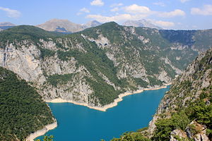
| The Piva reservoir near Plužine , with the Maglić in the background | ||
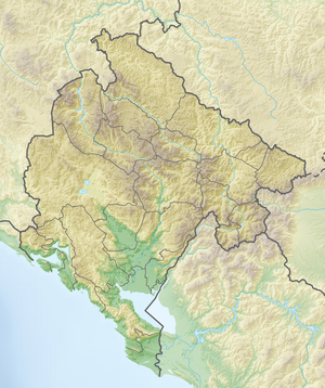
| Geographical location | Montenegro | |
| Tributaries | Piva | |
| Drain | Piva | |
| Location close to the shore | Plužine | |
| Data | ||
| Coordinates | 43 ° 10 ′ N , 18 ° 52 ′ E | |
|
|
||
| Altitude above sea level | 675 m | |
| surface | 12.5 km² | |
| length | 33 km | |
| Maximum depth | 188 m | |
The Pivsko jezero is a reservoir in northwest Montenegro and is the largest reservoir in the country.
The Piva is dammed about 3 km north of the village of Mratinje by the 220 m high Mratinje dam, which was built between 1971 and 1976 . The reservoir is about 33 km long, occupies an area of 12.5 km² and is up to 188 m deep. The lake is at an altitude of 675 m above sea level and is framed by forested mountains that rise to a height of almost 2000 m.
The reservoir floods the original location of the Piva monastery , which, in order to preserve it, was completely removed and rebuilt at its current location. The small town of Plužine , which lay in a vast, deep valley, was also flooded and its inhabitants were relocated to the newly built Plužine on the bank of the reservoir.
The hydropower plant below the dam generates a total output of 360 MW . The reservoir serves as a drinking water reservoir and is popular with water sports enthusiasts and anglers.
The European route E 762 runs along the lake and crosses it near Plužine.


