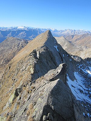
Piz Tanelin
| Piz Tanelin | ||
|---|---|---|
|
Piz Tanelin in summer |
||
| height | 2847 m above sea level M. | |
| location | Tujetsch , Quinto | |
| Mountains | Gotthard massif | |
| Coordinates | 698.07 thousand / 158587 | |
|
|
||
The Piz Tanelin (formerly Piz Tenelin ) is a mountain in the Gotthard massif .
The Piz Tanelin is 2847 m above sea level. M. high and lies between the Val Curnera in the north and the Val Cadlimo in the south. The areas of the Grisons municipality of Tujetsch and the Ticino municipality of Quinto meet at the summit .
literature
- Hiking map 1: 33'333, sheet 3314T Andermatt . Federal Office for Topography, Wabern 2014, ISBN 978-3-302-33314-4 .

