
Planet Path (Bonn)
The Bonn Planet Trail was inaugurated on Bonn's Rhine promenade in September 2002 after two years of preparatory work .
The path is 5.946 kilometers long and maps the solar system on a scale of one to a billion. At each station there is a bronze plaque that depicts the respective planet in relief and provides brief information about the planet shown - also in Braille . In addition, in April 2004 signs showing the path in its entirety were put up for better orientation. With the chosen scale, the distance between the earth and the moon is 38 centimeters; therefore these two celestial bodies were mounted on a common bronze plate. The model of the sun with an equatorial diameter of 1,392,000 km has a diameter of 1.5 meters and is located below the old waterworks on the Stresemannufer. An interesting side effect of the scale is that the closest fixed star ( Proxima Centauri ) would be almost exactly one circumference of the earth at a distance of 4.24 light years.
The model layout was created on the initiative of the Bertolt Brecht Comprehensive School in Bonn. The 7th grade students at the time were supported by training companies, chambers of crafts and sponsors from the region as well as the Marburg Institute for the Blind .

Sun (distance 0.0 m)

Mercury (distance 59.90 m)
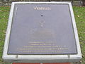
Venus (distance 108 m)

Earth (distance 150 m)

Mars (distance 228 m)

Jupiter (distance 778 m)

Saturn (distance 1427 m)

Uranus (distance 2870 m)

Neptune (distance 4497 m)
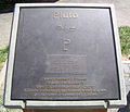
Pluto at the end of the path (distance 5946 m)


Web links
Coordinates: 50 ° 43 ′ 8.7 " N , 7 ° 7 ′ 41.6" E
Individual evidence
- ^ Stephan Trinius: Planetary Trail Bonn. Bonn Rhine promenade. In: General-Anzeiger . Archived from the original on December 4, 2014 ; accessed on March 25, 2018 (Planetary Trail Bonn).